Area Overview for NP19 4QP
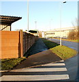
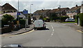
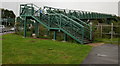
Photos of NP19 4QP


Area Information
Living in NP19 4QP offers a quiet residential experience within a specific postcode cluster in Wales. This small area spans just 6267 square metres and houses a population of 1279 people. The density stands at 725 people per square kilometre, indicating a close-knit local community rather than a sprawling suburb. You will find this area characterised by its compact nature, where daily travel distances to local services remain relatively short. The location sits near Liswerry, allowing access to broader town facilities while maintaining a distinct residential identity. Daily life here revolves around convenience and stability. With a median age of 47, the neighbourhood reflects a community where residents have established roots. The presence of houses as the primary accommodation type suggests a settled environment suited for long-term living. You can expect a setting where neighbours likely know one another, supported by the moderate population density. Proximity to Newport Railway Station and Pye Corner Railway Station means you can reach East Wales destinations without lengthy commutes. The area combines the benefits of a small residential pocket with the practicality of nearby transport links and amenities like Aldi Liswerry and Morrisons Somerton.
- Area Type
- Postcode
- Area Size
- 6267 m²
- Population
- 1279
- Population Density
- 725 people/km²
The property market in NP19 4QP is characterised by stability and ownership. With 80% of homes owned by buyers, this area functions as a traditional owner-occupied sector rather than a rental hotbed. You will find that the vast majority of properties here are houses, which typically command higher prices and offer more space than flats or terraced homes. This high ownership figure implies that many residents bought into the area years ago and have no intention of moving quickly. For prospective buyers, this means competition for available homes may sometimes arise if multiple interested parties view a specific property. However, the market also offers predictability. Because the housing stock is primarily comprised of houses, you can expect garden space and separate living areas that suit family life. The small size of the postcode, covering only 6267 square metres, means every single home carries significant weight in the local market dynamics. There are no luxury developments or exclusivity here; the market is grounded in practical, family-sized dwellings. This environment suits those seeking a tangible asset and a stable home base rather than a transient living situation.
House Prices in NP19 4QP
Showing 20 properties
| Address | Type | Beds | Baths | Last Sale Price | Last Sale Date | |
|---|---|---|---|---|---|---|
| 40 Hampshire Crescent, Newport, NP19 4QP | Semi-detached | 3 | 1 | £230,000 | Sep 2024 | |
| 41 Hampshire Crescent, Newport, NP19 4QP | Semi-detached | - | - | £245,000 | Aug 2023 | |
| 33 Hampshire Crescent, Newport, NP19 4QP | Semi-detached | 3 | 1 | £287,500 | Nov 2022 | |
| 47 Hampshire Crescent, Newport, NP19 4QP | Detached | 3 | 1 | £240,000 | Jul 2022 | |
| 44 Hampshire Crescent, Newport, NP19 4QP | Semi-detached | 3 | - | £149,000 | Oct 2017 | |
| 45 Hampshire Crescent, Newport, NP19 4QP | Semi-detached | - | - | £69,000 | Dec 2000 | |
| 49 Hampshire Crescent, Newport, NP19 4QP | house | - | - | £49,950 | Jun 1998 | |
| 37 Hampshire Crescent, Newport, NP19 4QP | Terraced | - | - | £56,000 | Mar 1997 | |
| 35 Hampshire Crescent, Newport, NP19 4QP | Semi-detached | 3 | 1 | - | - | |
| 43 Hampshire Crescent, Newport, NP19 4QP | Semi-detached | 3 | 1 | - | - |
Energy Efficiency in NP19 4QP
Life in NP19 4QP centres on convenient access to essential retail and leisure facilities. Supermarket choices are plentiful, with Aldi Liswerry, Morrisons Somerton, and Tesco Newport all within easy reach. These five major retail outlets ensure you can stock up on groceries without a major detour. Transport options further enhance your ability to leave the neighbourhood when desired. Five railway stations, including Newport Railway Station and Pye Corner Railway Station, offer quick access to wider Newport interests. A single ferry terminal, Newport Ferry Terminal, sits nearby, providing maritime connections to destinations across the Bristol Channel. This adds a unique travel dimension to your daily routine, suitable for weekend trips or spontaneous day voyages. While parks and playgrounds are not detailed in the current amenity list, the proximity of Newport exploits the wider region's green spaces. Dining and leisure venues will be found in the connected towns of Liswerry, Somerton, and the wider Newport city centre. The area supports a lifestyle where daily errands are short and major activities are just a short train ride away. This balance of local convenience and regional accessibility defines the local living experience.
Amenities
Schools
Families in NP19 4QP rely on local educational options that serve the wider neighbourhood. Lliswerry High School stands as the primary nearby institution for secondary education. This school serves as the main educational hub for young people attending school in the immediate vicinity of the postcode. While ofsted ratings are not listed in the current records, the presence of this school indicates a standard provision of education for the area. The school type for Lliswerry High School is listed as 'other', which distinguishes it from the standard maintained converter or academy classifications often seen elsewhere. This specific categorisation may reflect its governance structure or historical background within the Newport education system. For parents considering schools near NP19 4QP, this single option means that residential location directly influences which school your children will attend. There are no private schools or additional academy trusts currently identified in the immediate data for this specific area. Families generally settle here knowing that Lliswerry High School will meet their son's or daughter's educational needs during their teenage years.
| Rank | School | Type | Entry gender | Ages |
|---|
Explore more schools in this area
Go to Schools tabDemographics
The community in NP19 4QP is defined by a mature demographic profile. The median age here is 47, placing the most common age range firmly among adults between 30 and 64 years. This age structure points to a neighbourhood dominated by working families and established couples rather than young students or retirees seeking downsizing options. Most residents are homeowners, with home ownership levels reaching an impressive 80%. This high figure suggests financial stability and a strong desire to stay in one location for extended periods. Houses form the predominant accommodation type across this postcode area. While the breakdown of house sizes is not detailed in current records, the housing style generally supports family life. The ethnic composition is predominantly White, reflecting the broader demographic trends of Wales in this specific locality. You will find that the area lacks high-rise flats or shared ownership schemes as typical rental hubs might show. Instead, the stock consists of dedicated homes owned by residents who have chosen this spot for its stability. The low population density of 725 people per square kilometre reinforces the quiet, private nature of living arrangements here.
Household Size
Accommodation Type
Tenure
Ethnic Group
Religion
Household Composition
Age
Household Deprivation
NS-SEC
Explore more demographic insights in this area
Go to Demographics tabPlanning
Planning Constraints
- Flood RiskPremium
- Ramsar Wetland SitesPremium
- Area of Outstanding Natural BeautyPremium
- Protected Nature ReservePremium
- Protected WoodlandPremium
- Crime RiskPremium