Area Overview for NP19 0WF
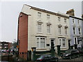
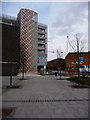
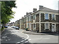
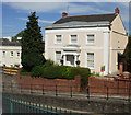
Photos of NP19 0WF


Area Information
The postcode NP19 0WF occupies a compact residential cluster of just 1.1 hectares within Wales. This small footprint supports a population of 2,905 residents, creating a tightly knit community environment. You are looking at an area defined by its density and specific location boundaries. The sheer number of people living in such a limited space results in a population density of 259,926 people per square kilometre. This high concentration suggests a neighbourhood where daily interactions are frequent and the local environment carries a distinct character shaped by its size. Living in NP19 0WF means navigating a zone where proximity to fellow residents is a defining feature of the daily experience. The area stands as a distinct residential focus rather than a sprawling development. Prospective buyers must consider this specific micro-location when evaluating their move to the Newport region. The combination of high density and small physical area creates a sense of immediacy for anyone considering homes in this postcode.
- Area Type
- Postcode
- Area Size
- 1.1 hectares
- Population
- 2905
- Population Density
- 9450 people/km²
Homes in NP19 0WF are primarily houses, reflecting the accommodation type data for this specific postcode. With 43% of residents being homeowners, you are looking at an area where ownership is a common aspiration and achievement. This ownership rate is significant but indicates that a substantial portion of the community still rents. The housing stock does not include flats, meaning buyers seeking a conventional detached or semi-detached property will find options that suit this profile. Living in NP19 0WF often means purchasing a house within a cluster of similar dwellings. The market here is characterised by a focus on single-family homes rather than shared living spaces. If you are considering properties in this zone, you should expect to look mainly at houses. The lack of flats in the accommodation type data limits choices for those preferring apartment-style living. Understanding this mix of home ownership and property type is essential before making an offer on any home in this compact area.
House Prices in NP19 0WF
No properties found in this postcode.
Energy Efficiency in NP19 0WF
Residents of NP19 0WF have convenient access to retail, rail, and ferry amenities that form the backbone of daily life. Supermarkets such as Lidl Granville, Sainsburys Newport John, and Asda Casnewydd are all within practical reach. These five retail options allow for easy grocery shopping and local provisioning without needing a long drive. Transport connectivity is supported by five nearby rail stations, including Newport Railway Station, Pye Corner Railway Station, and Rogerstone Railway Station. These stations facilitate quick journeys into the wider city and surrounding regions. Additionally, the Newport Ferry Terminal is available for one ferry service, offering alternative transport routes. With five rail links and one ferry terminal, the area provides multiple ways to leave or enter the community. You can walk to the button G for trains or drive straight to the terminal for the boat. The presence of so many nearby amenities means you do not need to travel far for essential services. Daily errands are manageable, whether you are filling up the car or catching a train for work.
Amenities
Schools
Maindee C.P. School stands as the primary educational institution near NP19 0WF. This school lists as an 'other' type within the surrounding network. For families considering schools near NP19 0WF, Maindee C.P. School is the key option currently identified for this location. The specific categorisation as 'other' indicates a community or primary institution rather than a comprehensive or independent secondary school. When evaluating education options for children in this postcode, you must rely on this single nearby provision. There are no secondary schools or specific rated comprehensive schools listed in the immediate vicinity of this small residential cluster. Parents often need to travel beyond the immediate 1.1-hectare boundary to access a broader range of educational choices. The presence of only one nearby school suggests that sending children to Maindee C.P. School is the standard route for local residents. Checking transport links to this specific school is a necessary step for any family moving into the area.
| Rank | School | Type | Entry gender | Ages |
|---|
Explore more schools in this area
Go to Schools tabDemographics
The community profile of NP19 0WF reflects a mature neighbourhood where adults form the core of the population. The median age sits at 47 years, indicating that the area is dominated by adults between the ages of 30 and 64. Forty-three per cent of residents own their homes, which points to a significant proportion of homeowners rather than tenants. The predominant form of accommodation consists of houses, meaning you will not find a concentration of high-rise flats or apartments in this housing stock. This type description aligns with the family-oriented age profile. While the predominant ethnic group is listed as Asian, the area maintains a mixed demographic makeup typical of established towns in Wales. There are no specific deprivation statistics provided in the current data to further analyse the socio-economic landscape. However, the high rate of home ownership alongside the age profile suggests stability for the majority of households. Living in NP19 0WF typically involves buying into a house-owning community where the demographic skew heavily towards middle-aged families.
Household Size
Accommodation Type
Tenure
Ethnic Group
Religion
Household Composition
Age
Household Deprivation
NS-SEC
Explore more demographic insights in this area
Go to Demographics tabPlanning
Planning Constraints
- Flood RiskPremium
- Ramsar Wetland SitesPremium
- Area of Outstanding Natural BeautyPremium
- Protected Nature ReservePremium
- Protected WoodlandPremium
- Crime RiskPremium