Area Overview for NP19 0JF
Photos of NP19 0JF


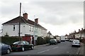
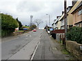
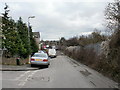
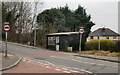
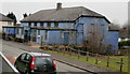
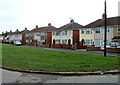
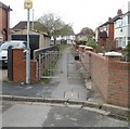
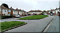
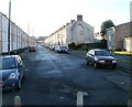
100 photos from this area
Area Information
Key information about the NP19 0JF including its size, population, and administrative classification.
- Area Type
- Postcode
- Area Size
- 5628 m²
- Population
- 1663
- Population Density
- 5518 people/km²
House Prices in NP19 0JF
18
Properties
£112,850
Average Sold Price
£48,000
Lowest Price
£260,000
Highest Price
Showing 18 properties
| Address | Type | Beds | Baths | Last Sale Price | Last Sale Date | |
|---|---|---|---|---|---|---|
| 17 Camperdown Road, Newport, NP19 0JF | Semi-detached | 5 | 1 | £260,000 | May 2024 | |
| 9 Camperdown Road, Newport, NP19 0JF | Terraced | 3 | - | £103,000 | Jan 2018 | |
| 3 Camperdown Road, Newport, NP19 0JF | Terraced | 1 | - | £120,000 | Jan 2017 | |
| 2 Camperdown Road, Newport, NP19 0JF | Semi-detached | 4 | 1 | £127,950 | May 2016 | |
| 4 Camperdown Road, Newport, NP19 0JF | house | 1 | - | £76,000 | Mar 2003 | |
| 14 CAMPERDOWN ROAD, Newport, NP19 0JF | Flat | - | - | £55,000 | Sep 2001 | |
| 6 Camperdown Road, Newport, NP19 0JF | Semi-detached | - | - | £48,000 | Oct 1995 | |
| Property Known As Flat 1, First Floor, 14 Camperdown Road, Newport, NP19 0JF | Flat | - | - | - | - | |
| Church Office, Ground Floor, 14 Camperdown Road, Newport, NP19 0JF | Office | - | - | - | - | |
| 10 Camperdown Road, Newport, NP19 0JF | Semi-detached | - | - | - | - |
Page 1 of 2
Energy Efficiency in NP19 0JF
Amenities
Schools
| Rank | School | Type | Entry gender | Ages |
|---|
Explore more schools in this area
Go to Schools tabDemographics
Household Size
One person
most common
Accommodation Type
Houses
most common
Tenure
50
majority
Ethnic Group
White
most common
Religion
N/A
most common
Household Composition
N/A
most common
Age
47
median
Adults (30-64 years)
most common
Household Deprivation
N/A
with no deprivation
NS-SEC
18
in Lower managerial occupations
Explore more demographic insights in this area
Go to Demographics tabPlanning
Planning Constraints
- Flood RiskPremium
- Ramsar Wetland SitesPremium
- Area of Outstanding Natural BeautyPremium
- Protected Nature ReservePremium
- Protected WoodlandPremium
- Crime RiskPremium