Area Overview for NP19 0GJ
Photos of NP19 0GJ
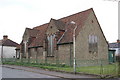
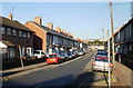
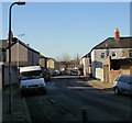
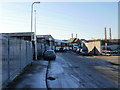

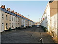
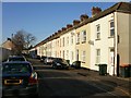
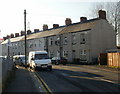
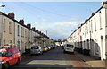
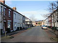
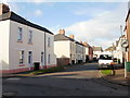
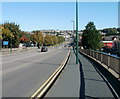
100 photos from this area
Area Information
Key information about the NP19 0GJ including its size, population, and administrative classification.
- Area Type
- Postcode
- Area Size
- 1.3 hectares
- Population
- 1424
- Population Density
- 6189 people/km²
House Prices in NP19 0GJ
32
Properties
£96,931
Average Sold Price
£31,000
Lowest Price
£180,000
Highest Price
Showing 32 properties
| Address | Type | Beds | Baths | Last Sale Price | Last Sale Date | |
|---|---|---|---|---|---|---|
| 15 Portskewett Street, Newport, NP19 0GJ | Terraced | 3 | - | £110,000 | Oct 2025 | |
| 2 Portskewett Street, Newport, NP19 0GJ | Terraced | 3 | 1 | £165,000 | Nov 2024 | |
| 4 Portskewett Street, Newport, NP19 0GJ | Semi-detached | 2 | 1 | £140,000 | May 2024 | |
| 18 Portskewett Street, Newport, NP19 0GJ | Terraced | 3 | 1 | £125,000 | Jul 2023 | |
| 16 Portskewett Street, Newport, NP19 0GJ | Terraced | 3 | 1 | £152,000 | Dec 2022 | |
| 22 Portskewett Street, Newport, NP19 0GJ | Terraced | 3 | 1 | £124,000 | May 2022 | |
| Ty Heulog, 4A Portskewett Street, Newport, NP19 0GJ | Semi-detached | 3 | 2 | £180,000 | Aug 2021 | |
| 9 Portskewett Street, Newport, NP19 0GJ | Terraced | 3 | 1 | £114,500 | Aug 2020 | |
| 6 Portskewett Street, Newport, NP19 0GJ | house | 3 | 1 | £123,000 | Oct 2019 | |
| 29 Portskewett Street, Newport, NP19 0GJ | Terraced | 3 | - | £75,000 | Dec 2018 |
Page 1 of 4
Energy Efficiency in NP19 0GJ
Amenities
Schools
| Rank | School | Type | Entry gender | Ages |
|---|
Explore more schools in this area
Go to Schools tabDemographics
Household Size
Family (3-5 people)
most common
Accommodation Type
Houses
most common
Tenure
65
majority
Ethnic Group
White
most common
Religion
N/A
most common
Household Composition
N/A
most common
Age
47
median
Adults (30-64 years)
most common
Household Deprivation
N/A
with no deprivation
NS-SEC
21
in Lower managerial occupations
Explore more demographic insights in this area
Go to Demographics tabPlanning
Planning Constraints
- Flood RiskPremium
- Ramsar Wetland SitesPremium
- Area of Outstanding Natural BeautyPremium
- Protected Nature ReservePremium
- Protected WoodlandPremium
- Crime RiskPremium