Area Overview for NP19 0DJ
Photos of NP19 0DJ
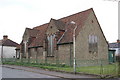
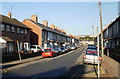
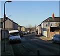
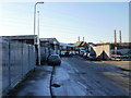

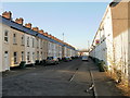
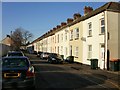
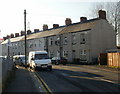
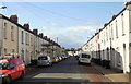
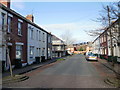
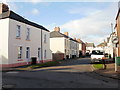
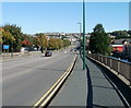
100 photos from this area
Area Information
Key information about the NP19 0DJ including its size, population, and administrative classification.
- Area Type
- Postcode
- Area Size
- 8151 m²
- Population
- 2212
- Population Density
- 8778 people/km²
House Prices in NP19 0DJ
24
Properties
£184,314
Average Sold Price
£105,000
Lowest Price
£260,000
Highest Price
Showing 24 properties
| Address | Type | Beds | Baths | Last Sale Price | Last Sale Date | |
|---|---|---|---|---|---|---|
| 24 Willenhall Street, Newport, NP19 0DJ | house | - | - | £215,000 | Sep 2025 | |
| 18 Willenhall Street, Newport, NP19 0DJ | Detached | 3 | 1 | £255,000 | Dec 2024 | |
| 20 Willenhall Street, Newport, NP19 0DJ | house | 3 | 2 | £260,000 | Jun 2022 | |
| 23 Willenhall Street, Newport, NP19 0DJ | Semi-detached | 3 | - | £199,950 | Jun 2021 | |
| 14 Willenhall Street, Newport, NP19 0DJ | Detached | 3 | 2 | £205,000 | Dec 2020 | |
| 22 Willenhall Street, Newport, NP19 0DJ | house | - | - | £123,500 | May 2016 | |
| 15 Willenhall Street, Newport, NP19 0DJ | house | - | - | £150,000 | Feb 2014 | |
| 16 Willenhall Street, Newport, NP19 0DJ | Detached | - | - | £217,000 | Sep 2007 | |
| 17 Willenhall Street, Newport, NP19 0DJ | house | 4 | - | £182,000 | Jun 2006 | |
| 21 Willenhall Street, Newport, NP19 0DJ | Detached | - | - | £115,000 | Jul 2003 |
Page 1 of 3
Energy Efficiency in NP19 0DJ
Amenities
Schools
| Rank | School | Type | Entry gender | Ages |
|---|
Explore more schools in this area
Go to Schools tabDemographics
Household Size
Family (3-5 people)
most common
Accommodation Type
Houses
most common
Tenure
53
majority
Ethnic Group
White
most common
Religion
N/A
most common
Household Composition
N/A
most common
Age
47
median
Adults (30-64 years)
most common
Household Deprivation
N/A
with no deprivation
NS-SEC
20
in Lower managerial occupations
Explore more demographic insights in this area
Go to Demographics tabPlanning
Planning Constraints
- Flood RiskPremium
- Ramsar Wetland SitesPremium
- Area of Outstanding Natural BeautyPremium
- Protected Nature ReservePremium
- Protected WoodlandPremium
- Crime RiskPremium