Area Overview for NP18 2EX
Photos of NP18 2EX
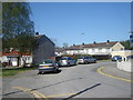


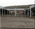

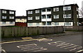


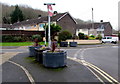

18 photos from this area
Area Information
Key information about the NP18 2EX including its size, population, and administrative classification.
- Area Type
- Postcode
- Area Size
- 21.6 hectares
- Population
- 1780
- Population Density
- 47 people/km²
House Prices in NP18 2EX
52
Properties
£115,982
Average Sold Price
£21,460
Lowest Price
£200,000
Highest Price
Showing 52 properties
| Address | Type | Beds | Baths | Last Sale Price | Last Sale Date | |
|---|---|---|---|---|---|---|
| 20 Willow Drive, Llanmartin, Newport, NP18 2EX | Terraced | 3 | 1 | £200,000 | Jun 2025 | |
| 12 Willow Drive, Llanmartin, Newport, NP18 2EX | Terraced | 3 | 1 | £185,000 | Dec 2024 | |
| 9 Willow Drive, Llanmartin, Newport, NP18 2EX | Terraced | 3 | 1 | £195,000 | Nov 2023 | |
| 40 Willow Drive, Llanmartin, Newport, NP18 2EX | Terraced | 3 | 1 | £200,000 | Nov 2023 | |
| 13 Willow Drive, Llanmartin, Newport, NP18 2EX | Terraced | 3 | 1 | £167,000 | Feb 2022 | |
| 4 Willow Drive, Llanmartin, Newport, NP18 2EX | Terraced | 3 | - | £181,000 | Jan 2022 | |
| 7 Willow Drive, Llanmartin, Newport, NP18 2EX | Terraced | 3 | 2 | £176,750 | Jun 2020 | |
| 31 Willow Drive, Llanmartin, Newport, NP18 2EX | Terraced | 3 | - | £152,000 | Dec 2018 | |
| 23 Willow Drive, Llanmartin, Newport, NP18 2EX | house | - | - | £140,000 | Mar 2018 | |
| 1 Willow Drive, Llanmartin, Newport, NP18 2EX | Terraced | 3 | 1 | £122,500 | Sep 2017 |
Page 1 of 6
Energy Efficiency in NP18 2EX
Amenities
Schools
| Rank | School | Type | Entry gender | Ages |
|---|
Explore more schools in this area
Go to Schools tabDemographics
Household Size
Two person
most common
Accommodation Type
Houses
most common
Tenure
79
majority
Ethnic Group
White
most common
Religion
N/A
most common
Household Composition
N/A
most common
Age
47
median
Adults (30-64 years)
most common
Household Deprivation
N/A
with no deprivation
NS-SEC
37
in Lower managerial occupations
Explore more demographic insights in this area
Go to Demographics tabPlanning
Planning Constraints
- Flood RiskPremium
- Ramsar Wetland SitesPremium
- Area of Outstanding Natural BeautyPremium
- Protected Nature ReservePremium
- Protected WoodlandPremium
- Crime RiskPremium