Area Overview for NP18 2DF
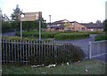
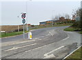
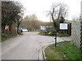
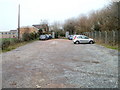
Photos of NP18 2DF


Area Information
Living in NP18 2DF places you within a tightly clustered residential zone covering just 3.1 hectares in the heart of Wales. This specific postcode serves 1,233 residents, creating a neighbourhood where public spaces are inherently scarce due to the high population density of 39,947 people per square kilometre. You are situated in a setting that prioritises close community proximity over expansive green buffers, a reality defined by the sheer number of households packed into such a small footprint. Life here moves at a pace dictated by your immediate neighbours, reflecting the character of a mature settlement rather than a sprawling suburb. The area functions as a distinct residential unit within Newport, offering a shielded environment where daily routines are shaped by the concentration of homes rather than wide-open roads. For those seeking a specific slice of Welsh life, NP18 2DF delivers a concentrated experience where the distinction between home and neighbour is significantly blurred by the land usage statistics.
- Area Type
- Postcode
- Area Size
- 3.1 hectares
- Population
- 1233
- Population Density
- 1987 people/km²
The property market in NP18 2DF is characterised by a housing stock where houses constitute the main accommodation type. With 52% of the population owning their homes, the area leans heavily into homeownership rather than a rental-driven economy. This high ownership rate suggests that prices in this 3.1-hectare cluster are likely influenced by established market values and long-term investment rather than speculative short-term lets. Buyers entering the market for homes in NP18 2DF should anticipate a competitive environment for traditional property formats, given the density of 39,947 people per square kilometre. The limited land area of 3.1 hectares restricts new build expansion, meaning competition centres on existing stock within the postcode. You will find a market shaped by residents who have upgraded or stayed put for decades, resulting in a stable but potentially rigid supply. Understanding the 52% ownership figure helps frame your expectations for negotiation and availability when searching for properties in this specific Welsh locality.
House Prices in NP18 2DF
Showing 14 properties
Energy Efficiency in NP18 2DF
Residents of NP18 2DF enjoy immediate access to major retail and leisure hubs due to the strategic location of this Newport postcode. Within practical reach, you have five key retail venues including Asda Living, Iceland Newport, and M&S Newport RP, ensuring your daily shopping needs are met without long travel times. The area also connects seamlessly to larger transport nodes, with four railway stations including Newport Railway Station, Pye Corner Railway Station, and Rogerstone Railway Station located nearby. For those seeking coastal excursions, Newport Ferry Terminal sits close enough to include a day trip to the Isle of Wight or otherreachable centres. This proximity to diverse amenities means the small residential cluster of 3.1 hectares does not isolate you from city life. You can walk or take short local transport to supermarkets, then travel further to the ferry terminal or rail stations as your day progresses. The blend of local convenience and major transport links defines the lifestyle of anyone calling NP18 2DF home.
Amenities
Schools
Families living in NP18 2DF have access to a network of educational institutions, including Ringland Infant School and Ringland Junior School, both located within the immediate vicinity. The primary education phase is served by Ringland Primary, Ringland Infant School, and Ringland Junior School, creating a seamless catchment path for younger children. For older students, Ysgol Gymraeg Casnewydd and Llanwern High School serve as the key secondary options. This mix of schools caters to different age groups and educational preferences, offering a route from early years through to senior secondary education. The presence of Ysgol Gymraeg Casnewydd specifically provides a Welsh language education option, which is a vital consideration for parents valuing bilingual learning. Living in NP18 2DF means your children can generally access the local school system without extensive commuting. The school names provided—Ringland Primary, Ringland Junior School, Ysgol Gymraeg Casnewydd, and Llanwern High School—form the backbone of the local educational landscape for residents of this small residential cluster.
| Rank | School | Type | Entry gender | Ages |
|---|
Explore more schools in this area
Go to Schools tabDemographics
The community of NP18 2DF is defined by stability, with a median age of 47 years reflecting a population anchored in adulthood. Most residents fall into the 30 to 64 years old bracket, indicating a household structure built around established families and long-term workers rather than transient young professionals or retirees. Home ownership stands at 52%, marking the area as a predominantly owner-occupied zone where residents have likely stayed through life stages rather than constantly chasing short-term rentals. Houses form the primary accommodation type, suggesting a streetscape dominated by detached or semi-detached structures rather than high-rise blocks or flats. While the data identifies White as the predominant ethnic group, the social fabric is cohesive without being an enclave of exclusion. The high density of 39,947 people per square kilometre creates a vibrant, immediate neighbourly feel, while the age profile ensures that schools and services remain relevant to a broad demographic range. You are dealing with a settled community where residents value permanence and local integration.
Household Size
Accommodation Type
Tenure
Ethnic Group
Religion
Household Composition
Age
Household Deprivation
NS-SEC
Explore more demographic insights in this area
Go to Demographics tabPlanning
Planning Constraints
- Flood RiskPremium
- Ramsar Wetland SitesPremium
- Area of Outstanding Natural BeautyPremium
- Protected Nature ReservePremium
- Protected WoodlandPremium
- Crime RiskPremium