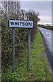
Area Overview for NP18 2AY
Photos of NP18 2AY

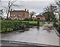

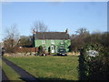
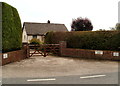
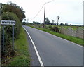

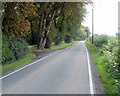

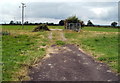
26 photos from this area
Area Information
Key information about the NP18 2AY including its size, population, and administrative classification.
- Area Type
- Postcode
- Area Size
- 1.9 km²
- Population
- 1780
- Population Density
- 47 people/km²
House Prices in NP18 2AY
27
Properties
£384,117
Average Sold Price
£230,000
Lowest Price
£654,200
Highest Price
Showing 27 properties
| Address | Type | Beds | Baths | Last Sale Price | Last Sale Date | |
|---|---|---|---|---|---|---|
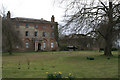
| Court House, Whitson Road, Whitson, Newport, NP18 2AY | Detached | 6 | 4 | £654,200 | Dec 2025 | |
| Whitson Lodge, Whitson Road, Whitson, Newport, NP18 2AY | Detached | - | - | £277,500 | Feb 2019 | |
| Wainbridge, Whitson Road, Whitson, Newport, NP18 2AY | Detached | - | - | £280,000 | Dec 2007 | |
| Whitson Court, Whitson Road, Whitson, Newport, NP18 2AY | Retail | - | - | £500,000 | Oct 2007 | |
| Parklands, Whitson Road, Whitson, Newport, NP18 2AY | Bungalow | - | - | £363,000 | Mar 2007 | |
| Lodge Farm, Whitson Road, Whitson, Newport, NP18 2AY | Detached | - | - | £230,000 | Apr 2005 | |
| Greenmead, Whitson Road, Whitson, Newport, NP18 2AY | Detached | 3 | 1 | - | - | |
| Caravan, Lodge Farm, Whitson Road, Whitson, Newport, NP18 2AY | Mobile Home | - | - | - | - | |
| Caravan Storage To The North And East Of Court Farm, Whitson Road, Whitson, Newport, NP18 2AY | warehouse | - | - | - | - | |
| Court Farm, Whitson Road, Whitson, Newport, NP18 2AY | Farm | - | - | - | - |
Page 1 of 3
Energy Efficiency in NP18 2AY
Amenities
Schools
| Rank | School | Type | Entry gender | Ages |
|---|
Explore more schools in this area
Go to Schools tabDemographics
Household Size
Two person
most common
Accommodation Type
Houses
most common
Tenure
79
majority
Ethnic Group
White
most common
Religion
N/A
most common
Household Composition
N/A
most common
Age
47
median
Adults (30-64 years)
most common
Household Deprivation
N/A
with no deprivation
NS-SEC
37
in Lower managerial occupations
Explore more demographic insights in this area
Go to Demographics tabPlanning
Planning Constraints
- Flood RiskPremium
- Ramsar Wetland SitesPremium
- Area of Outstanding Natural BeautyPremium
- Protected Nature ReservePremium
- Protected WoodlandPremium
- Crime RiskPremium