Area Overview for NP10 9SG
Photos of NP10 9SG
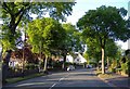
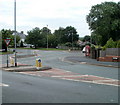
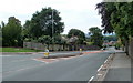
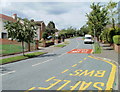


100 photos from this area
Area Information
Key information about the NP10 9SG including its size, population, and administrative classification.
- Area Type
- Postcode
- Area Size
- 6.7 hectares
- Population
- 1569
- Population Density
- 3448 people/km²
House Prices in NP10 9SG
38
Properties
£189,470
Average Sold Price
£56,000
Lowest Price
£437,000
Highest Price
Showing 38 properties
| Address | Type | Beds | Baths | Last Sale Price | Last Sale Date | |
|---|---|---|---|---|---|---|
| 71 Glasllwch Crescent, Newport, NP10 9SG | Semi-detached | 5 | 2 | £360,000 | Sep 2025 | |
| 90 Glasllwch Crescent, Newport, NP10 9SG | Semi-detached | 4 | 2 | £437,000 | Aug 2023 | |
| 86 Glasllwch Crescent, Newport, NP10 9SG | Semi-detached | 3 | 1 | £320,000 | Apr 2023 | |
| 82 Glasllwch Crescent, Newport, NP10 9SG | house | - | - | £140,000 | Feb 2023 | |
| Universal Pentecostal Church, 85 Glasllwch Crescent, Newport, NP10 9SG | house | - | - | £332,000 | Sep 2022 | |
| 87 Glasllwch Crescent, Newport, NP10 9SG | Semi-detached | 3 | 1 | £249,000 | Aug 2021 | |
| 75 Glasllwch Crescent, Newport, NP10 9SG | house | - | - | £177,000 | Jan 2021 | |
| 74 Glasllwch Crescent, Newport, NP10 9SG | Semi-detached | 3 | 1 | £219,950 | Jul 2019 | |
| 73 Glasllwch Crescent, Newport, NP10 9SG | Semi-detached | 3 | 1 | £214,000 | Feb 2019 | |
| 97 Glasllwch Crescent, Newport, NP10 9SG | Semi-detached | 3 | 1 | £210,000 | Sep 2017 |
Page 1 of 4
Energy Efficiency in NP10 9SG
Amenities
Schools
| Rank | School | Type | Entry gender | Ages |
|---|
Explore more schools in this area
Go to Schools tabDemographics
Household Size
Family (3-5 people)
most common
Accommodation Type
Houses
most common
Tenure
74
majority
Ethnic Group
White
most common
Religion
N/A
most common
Household Composition
N/A
most common
Age
47
median
Adults (30-64 years)
most common
Household Deprivation
N/A
with no deprivation
NS-SEC
33
in Lower managerial occupations
Explore more demographic insights in this area
Go to Demographics tabPlanning
Planning Constraints
- Flood RiskPremium
- Ramsar Wetland SitesPremium
- Area of Outstanding Natural BeautyPremium
- Protected Nature ReservePremium
- Protected WoodlandPremium
- Crime RiskPremium