Area Overview for NP10 9LA
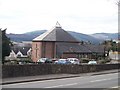
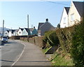
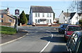
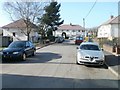
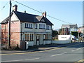
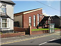
Photos of NP10 9LA
![Alongside the river [6] in NP10 9LA](https://images.propbar.co.uk/images/geograph/18/16/1816307_120.jpg)
![Alongside the river [7] in NP10 9LA](https://images.propbar.co.uk/images/geograph/18/16/1816309_120.jpg)
100 photos from this area
Area Information
Key information about the NP10 9LA including its size, population, and administrative classification.
- Area Type
- Postcode
- Area Size
- 3425 m²
- Population
- 2290
- Population Density
- 460 people/km²
House Prices in NP10 9LA
10
Properties
£151,940
Average Sold Price
£100,450
Lowest Price
£250,000
Highest Price
Showing 10 properties
| Address | Type | Beds | Baths | Last Sale Price | Last Sale Date | |
|---|---|---|---|---|---|---|
| 10 Crocus Close, Rogerstone, Newport, NP10 9LA | Detached | 3 | 1 | £250,000 | Jun 2025 | |
| 3 Crocus Close, Rogerstone, Newport, NP10 9LA | Terraced | 2 | 1 | £175,000 | Mar 2021 | |
| 2 Crocus Close, Rogerstone, Newport, NP10 9LA | Terraced | 2 | 1 | £160,000 | Jan 2019 | |
| 9 Crocus Close, Rogerstone, Newport, NP10 9LA | Semi-detached | 3 | 1 | £154,950 | Jul 2016 | |
| 7 Crocus Close, Rogerstone, Newport, NP10 9LA | house | 2 | 1 | £121,000 | Dec 2011 | |
| 5 Crocus Close, Rogerstone, Newport, NP10 9LA | Terraced | 3 | 1 | £150,000 | May 2008 | |
| 4 Crocus Close, Rogerstone, Newport, NP10 9LA | Terraced | - | - | £152,000 | Aug 2006 | |
| 1 Crocus Close, Rogerstone, Newport, NP10 9LA | Terraced | 2 | - | £129,000 | Dec 2003 | |
| 6 Crocus Close, Rogerstone, Newport, NP10 9LA | house | - | - | £100,450 | Dec 2003 | |
| 8 Crocus Close, Rogerstone, Newport, NP10 9LA | Terraced | - | - | £127,000 | Dec 2003 |
Energy Efficiency in NP10 9LA
Amenities
Schools
| Rank | School | Type | Entry gender | Ages |
|---|
Explore more schools in this area
Go to Schools tabDemographics
Household Size
Family (3-5 people)
most common
Accommodation Type
Houses
most common
Tenure
87
majority
Ethnic Group
White
most common
Religion
N/A
most common
Household Composition
N/A
most common
Age
47
median
Adults (30-64 years)
most common
Household Deprivation
N/A
with no deprivation
NS-SEC
49
in Lower managerial occupations
Explore more demographic insights in this area
Go to Demographics tabPlanning
Planning Constraints
- Flood RiskPremium
- Ramsar Wetland SitesPremium
- Area of Outstanding Natural BeautyPremium
- Protected Nature ReservePremium
- Protected WoodlandPremium
- Crime RiskPremium