Area Overview for NP10 8YF
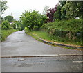
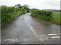
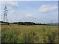
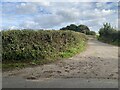
Photos of NP10 8YF


Area Information
Living in NP10 8YF means residing within a specific postcode cluster in Wales that defines a small, well-established residential environment. You will find a tightly knit community where the total population stands at 1,933 residents. The density here is measured at 168 people per square kilometre, indicating a settled neighbourhood rather than a sprawling development. This area is not a large metropolitan zone; it is a distinct pocket of housing designed for local living. Daily life focuses on proximity, with most daily needs satisfied through direct access to services nearby. The character of this location stems from its focus on domestic comfort and established homeownership. When you consider homes in NP10 8YF, you are looking at a space where the community structure is already formed. The area avoids the chaos of major transport hubs while maintaining reasonable access to wider networks. You will experience a quiet existence supported by robust infrastructure for digital and physical connections. This postcode represents a stable choice for those seeking a contained residential zone within the broader Welsh landscape.
- Area Type
- Postcode
- Area Size
- Not available
- Population
- 1933
- Population Density
- 168 people/km²
Looking at the property market in NP10 8YF reveals a landscape dominated by private ownership and traditional housing. With 87% of the area held by owners, this is fundamentally an owner-occupied market rather than a rental-focused district. You will encounter homes in NP10 8YF that have been maintained for generations by their current owners. The accommodation type is strictly houses, indicating a layout suitable for family living or single-family occupancy. There are no flats or purpose-built rentals in this specific postcode. The high ownership rate suggests that property prices often reflect long-term equity and stability. If you are considering buying HP10 8YF, you enter a market where sellers are unlikely to move for mere speculation. The housing supply is fixed to this low-density cluster, meaning the local market is defined by the existing stock of standalone homes. This structure appeals to buyers who prefer established properties over new developments. The absence of rental properties reduces noise and transient activity in the streets.
House Prices in NP10 8YF
No properties found in this postcode.
Energy Efficiency in NP10 8YF
Your daily lifestyle in NP10 8YF benefits from a cluster of essential amenities nearby. Five retail outlets are available for shopping needs, including Co-op Rogerstone, Morrisons Rogerstone, and Tesco Rogerstone. These supermarkets are close enough to support weekly grocery runs without requiring a long journey. There is also a diverse range of transport hubs nearby, with five rail stations serving the area. Furthermore, a single ferry terminal, Newport Ferry Terminal, is accessible for specific travel requirements. This concentration of services means you manage your day-to-day life without venturing far from home. You access food, goods, and transport connections through a compact network of established venues. The proximity of these retailers ensures convenience is built directly into your routine. You do not need to plan significant detours to reach basic necessities. The layout of NP10 8YF supports a self-contained life where the nearest facility is always within a short drive or walk.
Amenities
Schools
| Rank | School | Type | Entry gender | Ages |
|---|
Explore more schools in this area
Go to Schools tabDemographics
The community within NP10 8YF is defined by an older, settled demographic structure. The median age for residents is 47 years old, which significantly influences the daily rhythm of the neighbourhood. Most households consist of adults aged between 30 and 64 years. This age range suggests families with children or empty nesters rather than young people entering the rental market. Homeownership is the dominant feature here, with an impressive 87% of the housing stock owned by its occupants. Very few residents are tenants, which creates a stable environment with high attachment to property. The accommodation type is exclusively houses, meaning you will not find flats or blocks of apartments in this specific cluster. The predominant ethnic group is White, reflecting a long-standing settlement pattern in this part of Wales. You do not need to worry about rapidly shifting demographics or transient populations. The population profile offers a predictable environment where long-term residents have defined their local presence over many years.
Household Size
Accommodation Type
Tenure
Ethnic Group
Religion
Household Composition
Age
Household Deprivation
NS-SEC
Explore more demographic insights in this area
Go to Demographics tabPlanning
Planning Constraints
- Flood RiskPremium
- Ramsar Wetland SitesPremium
- Area of Outstanding Natural BeautyPremium
- Protected Nature ReservePremium
- Protected WoodlandPremium
- Crime RiskPremium