Area Overview for NP10 8NP
Photos of NP10 8NP

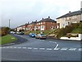
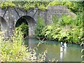
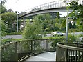


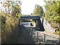


100 photos from this area
Area Information
Key information about the NP10 8NP including its size, population, and administrative classification.
- Area Type
- Postcode
- Area Size
- 1.3 hectares
- Population
- 2129
- Population Density
- 1702 people/km²
House Prices in NP10 8NP
37
Properties
£123,864
Average Sold Price
£80,000
Lowest Price
£290,000
Highest Price
Showing 37 properties
| Address | Type | Beds | Baths | Last Sale Price | Last Sale Date | |
|---|---|---|---|---|---|---|
| 22 Ruperra Close, Bassaleg, Newport, NP10 8NP | Flat | - | - | £140,000 | Apr 2023 | |
| 1 Ruperra Close, Bassaleg, Newport, NP10 8NP | Flat | - | - | £129,500 | Jun 2019 | |
| 24 Ruperra Close, Bassaleg, Newport, NP10 8NP | Flat | 2 | 1 | £110,000 | Dec 2016 | |
| The Woodlands, 1A Ruperra Close, Bassaleg, Newport, NP10 8NP | Detached | 3 | 2 | £290,000 | Feb 2016 | |
| 8 Ruperra Close, Bassaleg, Newport, NP10 8NP | Maisonette | - | - | £89,500 | Nov 2015 | |
| 16 Ruperra Close, Bassaleg, Newport, NP10 8NP | Flat | - | - | £110,000 | Aug 2015 | |
| 32 Ruperra Close, Bassaleg, Newport, NP10 8NP | Flat | - | - | £90,000 | Jul 2015 | |
| 30 Ruperra Close, Bassaleg, Newport, NP10 8NP | Flat | - | - | £80,000 | Jan 2012 | |
| 20 Ruperra Close, Bassaleg, Newport, NP10 8NP | Flat | - | - | £103,000 | May 2011 | |
| 12 Ruperra Close, Bassaleg, Newport, NP10 8NP | Flat | - | - | £111,500 | Mar 2007 |
Page 1 of 4
Energy Efficiency in NP10 8NP
Amenities
Schools
| Rank | School | Type | Entry gender | Ages |
|---|
Explore more schools in this area
Go to Schools tabDemographics
Household Size
Family (3-5 people)
most common
Accommodation Type
Houses
most common
Tenure
76
majority
Ethnic Group
White
most common
Religion
N/A
most common
Household Composition
N/A
most common
Age
47
median
Adults (30-64 years)
most common
Household Deprivation
N/A
with no deprivation
NS-SEC
44
in Lower managerial occupations
Explore more demographic insights in this area
Go to Demographics tabPlanning
Planning Constraints
- Flood RiskPremium
- Ramsar Wetland SitesPremium
- Area of Outstanding Natural BeautyPremium
- Protected Nature ReservePremium
- Protected WoodlandPremium
- Crime RiskPremium