Area Overview for NP10 8LS
Photos of NP10 8LS
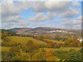
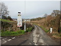
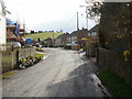

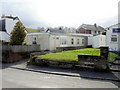
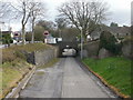
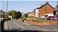
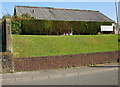
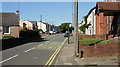
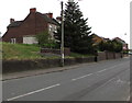
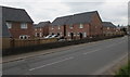
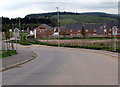
100 photos from this area
Area Information
Key information about the NP10 8LS including its size, population, and administrative classification.
- Area Type
- Postcode
- Area Size
- 2.1 hectares
- Population
- 1324
- Population Density
- 1442 people/km²
House Prices in NP10 8LS
11
Properties
£259,994
Average Sold Price
£76,000
Lowest Price
£499,999
Highest Price
Showing 11 properties
| Address | Type | Beds | Baths | Last Sale Price | Last Sale Date | |
|---|---|---|---|---|---|---|
| Bryn Deri, Caerphilly Road, Newport, NP10 8LS | Detached | 6 | 3 | £499,999 | Feb 2025 | |
| The Burrows, Caerphilly Road, Newport, NP10 8LS | Detached | 4 | 2 | £295,000 | Sep 2018 | |
| Oaklands, Caerphilly Road, Newport, NP10 8LS | house | 4 | - | £261,000 | Nov 2012 | |
| The Oaks, Caerphilly Road, Newport, NP10 8LS | Detached | 5 | 4 | £282,000 | Jul 2006 | |
| Bay Tree Cottage, Caerphilly Road, Newport, NP10 8LS | Detached | - | - | £365,000 | Jul 2004 | |
| Hillside, Caerphilly Road, Newport, NP10 8LS | Detached | - | - | £249,950 | Sep 2003 | |
| Yew Tree Cottage, Caerphilly Road, Newport, NP10 8LS | Detached | - | - | £152,000 | Jun 2003 | |
| The Mount, Caerphilly Road, Newport, NP10 8LS | Detached | 4 | 2 | £159,000 | Feb 2000 | |
| The Laurels, Caerphilly Road, Newport, NP10 8LS | Semi-detached | - | - | £76,000 | May 1999 | |
| Havenwood, Caerphilly Road, Newport, NP10 8LS | Detached | - | - | - | - |
Page 1 of 2
Energy Efficiency in NP10 8LS
Amenities
Schools
| Rank | School | Type | Entry gender | Ages |
|---|
Explore more schools in this area
Go to Schools tabDemographics
Household Size
Two person
most common
Accommodation Type
Houses
most common
Tenure
78
majority
Ethnic Group
White
most common
Religion
N/A
most common
Household Composition
N/A
most common
Age
47
median
Adults (30-64 years)
most common
Household Deprivation
N/A
with no deprivation
NS-SEC
48
in Lower managerial occupations
Explore more demographic insights in this area
Go to Demographics tabPlanning
Planning Constraints
- Flood RiskPremium
- Ramsar Wetland SitesPremium
- Area of Outstanding Natural BeautyPremium
- Protected Nature ReservePremium
- Protected WoodlandPremium
- Crime RiskPremium