Area Overview for NP10 0BL
Photos of NP10 0BL
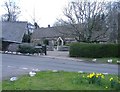
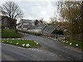
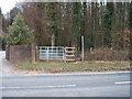
![In the wood [1] in NP10 0BL](https://images.propbar.co.uk/images/geograph/18/09/1809478_120.jpg)
86 photos from this area
Area Information
Key information about the NP10 0BL including its size, population, and administrative classification.
- Area Type
- Postcode
- Area Size
- 7875 m²
- Population
- 1252
- Population Density
- 1692 people/km²
House Prices in NP10 0BL
13
Properties
£232,917
Average Sold Price
£138,000
Lowest Price
£368,500
Highest Price
Showing 13 properties
| Address | Type | Beds | Baths | Last Sale Price | Last Sale Date | |
|---|---|---|---|---|---|---|
| 5 Mountford Close, Rogerstone, Newport, NP10 0BL | house | - | - | £368,500 | Jan 2021 | |
| 2 Mountford Close, Rogerstone, Newport, NP10 0BL | house | - | - | £333,500 | Jul 2019 | |
| 9 Mountford Close, Rogerstone, Newport, NP10 0BL | Detached | - | - | £190,000 | Nov 2002 | |
| 7 Mountford Close, Rogerstone, Newport, NP10 0BL | Detached | - | - | £205,000 | Oct 2000 | |
| 10 Mountford Close, Rogerstone, Newport, NP10 0BL | Detached | - | - | £162,500 | Sep 1997 | |
| 12 Mountford Close, Rogerstone, Newport, NP10 0BL | Detached | - | - | £138,000 | Oct 1995 | |
| 6A Mountford Close, Rogerstone, Newport, NP10 0BL | Flat | - | - | - | - | |
| 1 Mountford Close, Rogerstone, Newport, NP10 0BL | house | - | - | - | - | |
| 8 Mountford Close, Rogerstone, Newport, NP10 0BL | Detached | - | - | - | - | |
| 11 Mountford Close, Rogerstone, Newport, NP10 0BL | Detached | - | - | - | - |
Page 1 of 2
Energy Efficiency in NP10 0BL
Amenities
Schools
| Rank | School | Type | Entry gender | Ages |
|---|
Explore more schools in this area
Go to Schools tabDemographics
Household Size
Two person
most common
Accommodation Type
Houses
most common
Tenure
92
majority
Ethnic Group
White
most common
Religion
N/A
most common
Household Composition
N/A
most common
Age
47
median
Adults (30-64 years)
most common
Household Deprivation
N/A
with no deprivation
NS-SEC
53
in Lower managerial occupations
Explore more demographic insights in this area
Go to Demographics tabPlanning
Planning Constraints
- Flood RiskPremium
- Ramsar Wetland SitesPremium
- Area of Outstanding Natural BeautyPremium
- Protected Nature ReservePremium
- Protected WoodlandPremium
- Crime RiskPremium