Area Overview for Marshfield Community
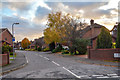
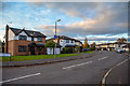
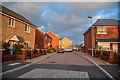
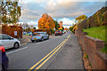
Photos of Marshfield Community

Area Information
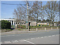
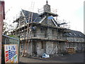
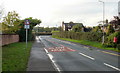
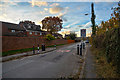
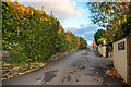
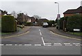
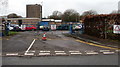
Living in Marshfield Community offers a distinct rural lifestyle within the Newport City Council area. This civil parish spans 5.8 km² and lies approximately 5 miles southwest of Newport city centre, positioning residents just 7 miles northeast of Cardiff. The local population stood at 3,054 according to the 2011 census, with the village administrative centre including the settlement of Castleton. Life here is anchored by the historic Church of St Mary the Virgin, a Grade II* listed building constructed in 1135 that serves as a key landmark for the 2,300-acre parish. Daily routines involve access to essential amenities including a village hall, post office, chemist, and a primary school with nursery provision. Sports facilities comprise a multi-use games area added to the hall grounds in 2017, alongside two active churches: St Mary's Church in Wales and Gateway Baptist Church. The economy has historically been significant, having previously hosted major employers such as the UK Patent Office and the Office for National Statistics within the wider ward. Today, the land remains agricultural, covering rich loam soil over gravel used for growing wheat, barley, oats, and pasture. This setting provides a quiet environment for residents who value proximity to historic sites and established green spaces without the busy city centre noise.
- Area Type
- Parish
- Area Size
- 5.8 km²
- Population
- Not available
- Population Density
- Not available
Demographics
The community profile of Marshfield reveals a settled population with a low turnover of residents. The median age for the area is 70, indicating a significant proportion of older adults call these homes home. By comparison, the most common age range generally sees higher density in urban wards, yet Marshfield shows a distinct skew towards retirement or senior living. Evidence suggests that 30 per cent of residents fall into the 60 to 74 age bracket, which aligns with the overall median age figure. This demographic profile often correlates with high rates of home ownership rather than renting. Home ownership stands at 87 per cent within the parish. Such a high figure suggests stability in who lives in Marshfield Community, as most inhabitants are responsible for major capital improvements and maintenance of their properties themselves. The remaining 13 per cent of households live in rented accommodation, which typically consists of smaller shares or student housing rather than long-term tenancies. The data indicates a homogenous community structure where families or older couples dominate the street scene. You will find that household composition leans towards single-person households or couples, matching the age profile. There is no specific data on ethnicity or religion breakdowns available for this location, so one should rely on the clear signs of a traditional Welsh village rather than expecting a recent influx of new ethnic groups. The environment feels timeless, consistent with a place recorded in the 1530s with origins stretching back to 1135.
Household Size
Accommodation Type
Tenure
Ethnic Group
Religion
Household Composition
Age
Household Deprivation
NS-SEC
Explore more demographic insights in this area
Go to Demographics tabPlanning
Planning Constraints
- Flood RiskPremium
- Ramsar Wetland SitesPremium
- Area of Outstanding Natural BeautyPremium
- Protected Nature ReservePremium
- Protected WoodlandPremium
- Crime RiskPremium