Area Overview for Llanvaches Community
Photos of Llanvaches Community
Area Information
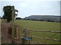
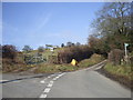
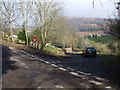
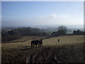
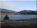
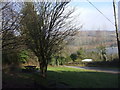
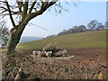
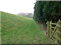
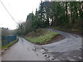
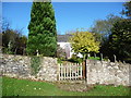
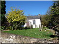
Living in Llanvaches Community offers a distinct experience within the boundaries of the city of Newport. This civil parish covers an area of 7.7 km² and sits approximately 51.6218°N 2.8186°W, positioned to the east of the main urban sprawl in the historic county of Monmouthshire. You will find a settlement deeply rooted in history rather than rapid modernisation. The village owes its name to Saint Maches, a 5th-century shepherdess, and stands upon land where the first Independent Church in Wales was founded in 1638–1639. The Tabernacle United Reformed Church remains a notable landmark, originally built as a chapel on Carrow Hill and later relocated to Tabernacle Road on the A48 corner. Daily life here reflects its status as a historic village within a larger city. The coordinates place it near 51.6296°N 2.8319°W, marking its specific location outside the dense core. The area serves as a quiet outpost where history meets contemporary living, though the lack of significant industrial development or protected nature reserves means the landscape, while containing 23.31 of protected woodland, is largely free from strict planning constraints found elsewhere in Wales. For you, this translates to a residential environment where the past remains visible in architecture and church history, while you navigate a parish that functions as a recognised community unit within the City of Newport.
- Area Type
- Parish
- Area Size
- 7.7 km²
- Population
- Not available
- Population Density
- Not available
Demographics
The population profile of Llanvaches Community is defined by an older demographic, with a median age of 70. This figure indicates that the residents aged 70 and above make up a significant portion of the total population. You should expect a community where the traditional nuclear family is less common than among younger cohorts in other parts of the UK. The data highlights that the most common age range covers the entire population spectrum, yet the central tendency strongly points toward retirement communities or long-term residents who have remained in their homes for decades. Home ownership stands at 88% across the parish, creating an environment where buyers find more of the qualified stock than they do rental properties. This high ownership rate suggests stability, as tenants are rare and residents are likely deeply embedded in the local history. The household composition reflects this, with total households showing a pattern consistent with the age profile, likely favouring single occupants or couples living alone. The accommodation types align with this demographic, offering housing suited to older tastes rather than attracting young professionals seeking dense urban regeneration. You will not find significant data regarding predominant ethnic groups or religious breakdown in the current records, so the community presents as broadly representative of the wider rural Welsh experience. The high home ownership percentage means negotiations for purchase centres on value and property condition rather than competition with other tenants or investors. For you, this area represents a stable environment where the majority of neighbours have put down roots and intend to stay, making it a suitable choice if you seek a lower turnover community.
Household Size
Accommodation Type
Tenure
Ethnic Group
Religion
Household Composition
Age
Household Deprivation
NS-SEC
Explore more demographic insights in this area
Go to Demographics tabPlanning
Planning Constraints
- Flood RiskPremium
- Ramsar Wetland SitesPremium
- Area of Outstanding Natural BeautyPremium
- Protected Nature ReservePremium
- Protected WoodlandPremium
- Crime RiskPremium