Area Overview for CF3 2UP
Photos of CF3 2UP
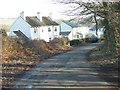
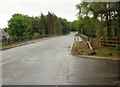
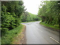
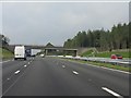

48 photos from this area
Area Information
Key information about the CF3 2UP including its size, population, and administrative classification.
- Area Type
- Postcode
- Area Size
- 7.4 hectares
- Population
- 1454
- Population Density
- 165 people/km²
House Prices in CF3 2UP
6
Properties
£283,917
Average Sold Price
£141,500
Lowest Price
£365,000
Highest Price
Showing 6 properties
| Address | Type | Beds | Baths | Last Sale Price | Last Sale Date | |
|---|---|---|---|---|---|---|
| 2 Channel View, Castleton, Cardiff, CF3 2UP | house | - | - | £365,000 | Dec 2021 | |
| 1 Channel View, Castleton, Cardiff, CF3 2UP | Semi-detached | 3 | 2 | £350,000 | Dec 2020 | |
| Craig-yr-haul Cottage, Channel View, Castleton, Cardiff, CF3 2UP | Cottage | 3 | 2 | £347,000 | Nov 2020 | |
| Hazeldene, Channel View, Castleton, Cardiff, CF3 2UP | Cottage | 3 | 2 | £320,000 | Nov 2015 | |
| 4 Channel View, Castleton, Cardiff, CF3 2UP | Semi-detached | - | - | £180,000 | Aug 2006 | |
| 3 Channel View, Castleton, Cardiff, CF3 2UP | Semi-detached | - | - | £141,500 | Jan 2005 |
Energy Efficiency in CF3 2UP
Amenities
Schools
| Rank | School | Type | Entry gender | Ages |
|---|
Explore more schools in this area
Go to Schools tabDemographics
Household Size
Family (3-5 people)
most common
Accommodation Type
Houses
most common
Tenure
92
majority
Ethnic Group
White
most common
Religion
N/A
most common
Household Composition
N/A
most common
Age
47
median
Adults (30-64 years)
most common
Household Deprivation
N/A
with no deprivation
NS-SEC
53
in Lower managerial occupations
Explore more demographic insights in this area
Go to Demographics tabPlanning
Planning Constraints
- Flood RiskPremium
- Ramsar Wetland SitesPremium
- Area of Outstanding Natural BeautyPremium
- Protected Nature ReservePremium
- Protected WoodlandPremium
- Crime RiskPremium