Area Overview for CF3 2UL
Photos of CF3 2UL

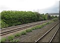
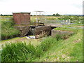
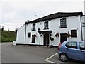
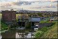

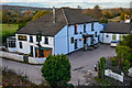

84 photos from this area
Area Information
Key information about the CF3 2UL including its size, population, and administrative classification.
- Area Type
- Postcode
- Area Size
- 6.7 hectares
- Population
- 2078
- Population Density
- 569 people/km²
House Prices in CF3 2UL
41
Properties
£126,607
Average Sold Price
£45,000
Lowest Price
£195,000
Highest Price
Showing 41 properties
| Address | Type | Beds | Baths | Last Sale Price | Last Sale Date | |
|---|---|---|---|---|---|---|
| 43 Pentwyn Terrace, Marshfield, Cardiff, CF3 2UL | Terraced | 3 | 1 | £195,000 | Dec 2024 | |
| 66 Pentwyn Terrace, Marshfield, Cardiff, CF3 2UL | Terraced | 2 | 1 | £152,000 | Sep 2022 | |
| 42 Pentwyn Terrace, Marshfield, Cardiff, CF3 2UL | house | - | - | £160,000 | Jan 2022 | |
| 87 Pentwyn Terrace, Marshfield, Cardiff, CF3 2UL | Terraced | 3 | 1 | £176,000 | Dec 2021 | |
| 91 Pentwyn Terrace, Marshfield, Cardiff, CF3 2UL | house | - | - | £167,000 | Jun 2018 | |
| 54 Pentwyn Terrace, Marshfield, Cardiff, CF3 2UL | Terraced | 3 | 1 | £162,000 | Jul 2017 | |
| 63 Pentwyn Terrace, Marshfield, Cardiff, CF3 2UL | Terraced | 2 | - | £112,000 | Sep 2015 | |
| 93 Pentwyn Terrace, Marshfield, Cardiff, CF3 2UL | Terraced | - | - | £90,000 | Dec 2014 | |
| 83 Pentwyn Terrace, Marshfield, Cardiff, CF3 2UL | Terraced | 3 | - | £128,500 | Aug 2014 | |
| 69 Pentwyn Terrace, Marshfield, Cardiff, CF3 2UL | house | - | - | £96,000 | Feb 2006 |
Page 1 of 5
Energy Efficiency in CF3 2UL
Amenities
Schools
| Rank | School | Type | Entry gender | Ages |
|---|
Explore more schools in this area
Go to Schools tabDemographics
Household Size
Family (3-5 people)
most common
Accommodation Type
Houses
most common
Tenure
84
majority
Ethnic Group
White
most common
Religion
N/A
most common
Household Composition
N/A
most common
Age
47
median
Adults (30-64 years)
most common
Household Deprivation
N/A
with no deprivation
NS-SEC
45
in Lower managerial occupations
Explore more demographic insights in this area
Go to Demographics tabPlanning
Planning Constraints
- Flood RiskPremium
- Ramsar Wetland SitesPremium
- Area of Outstanding Natural BeautyPremium
- Protected Nature ReservePremium
- Protected WoodlandPremium
- Crime RiskPremium