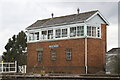
Area Overview for Bishton Community
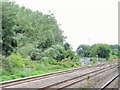
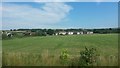
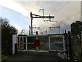
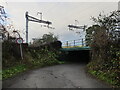
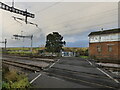
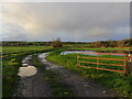
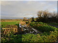
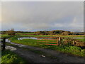
Photos of Bishton Community
Area Information
Living in Bishton Community means calling a civil parish home in Wales, a distinct area defined by its rural character. This settlement covers an area size of 6.9 square kilometres, offering a compact yet self-contained environment for residents. You will find that daily life here revolves around a quiet pace, typical for a parish of this scale in the Welsh countryside. The location provides a sheltered setting where green spaces and residential areas coexist without the density of larger towns. Prospective buyers looking for a lifestyle away from urban sprawl will find this parish delivers exactly that. You get proximity to local amenities while maintaining the sense of space that defines living in Bishton Community. The tight geographic footprint ensures that essential services are reasonably accessible, yet the landscape retains its open, countryside feel. Homebuyers seeking a defined boundary for their property search appreciate how this parish is neatly circumscribed. Whether you are commuting or staying local, the settlement structure of this Welsh community supports a grounded, community-focused way of life. The physical limits of the area help create a stable neighbourhood identity, making it easy to navigate and settle into.
- Area Type
- Parish
- Area Size
- 6.9 km²
- Population
- Not available
- Population Density
- Not available
Demographics
The people of Bishton Community reflect a settled population with a clear peak in older age groups. The median age stands at 70, indicating that residents are significantly older than the national average. This demographic profile suggests a village where families raise children elsewhere, and retirees move back or choose to retire in peace. Home ownership levels are high, with 71% of residents owning their homes outright. This statistic confirms that financial independence and long-term stability characterise the local household composition. You will encounter fewer landlords and more owners who have established roots over many years. The settlement does not display a typical young professional demographic or a transient presence. Accommodation reflects the needs of an ageing population rather than a dynamic start-up scene. Living in Bishton Community means sharing streets neighbours who have lived there decades. This stability fosters a quiet atmosphere where community connections often rely on long-standing recognition rather than new socialised introductions. The absence of young age groups shapes everything from local events to pub openings.
Household Size
Accommodation Type
Tenure
Ethnic Group
Religion
Household Composition
Age
Household Deprivation
NS-SEC
Explore more demographic insights in this area
Go to Demographics tabPlanning
Planning Constraints
- Flood RiskPremium
- Ramsar Wetland SitesPremium
- Area of Outstanding Natural BeautyPremium
- Protected Nature ReservePremium
- Protected WoodlandPremium
- Crime RiskPremium