Area Overview for Rogerstone Community
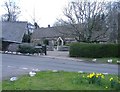
Photos of Rogerstone Community
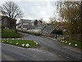
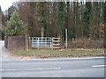
![In the wood [1] in Rogerstone Community](https://images.propbar.co.uk/images/geograph/18/09/1809478_120.jpg)
Area Information
Rogerstone Community stands as distinct within the Welsh landscape as a civil parish with an area size of exactly 9.0 km². This settlement forms a suburban area situated north of Newport city centre in Monmouthshire. The current population totals 2,672 residents, creating a neighbourhood that balances rural heritage with modern suburban development. Historically, the village evolved from the ancient parish of Bassaleg and expanded rapidly during the industrial revolution due to its proximity to the South Wales coalfield. Recent history shows a shift from a traditionally industrial village into an affluent suburban area, particularly following new housing developments on the former power station site. These additions have introduced over 1,000 new dwellings and attracted a predominantly middle-class population seeking good schools and access to the countryside. You will find that daily life here is characterised by a mix of historic charm and contemporary convenience. The area retains significant historical sites, including a Carnegie Library opened in 1905 and the Monmouthshire Canal, which features the Fourteen Locks and runs through the heart of the settlement. This blend of old and new defines living in Rogerstone, offering residents a community with deep roots that has successfully adapted to modern family needs.
- Area Type
- Parish
- Area Size
- 9.0 km²
- Population
- 2672
- Population Density
- 296 people/km²
Demographics
The community in Rogerstone Community displays a clear demographic profile centred around older age groups. The median age is 70, indicating that the population skews significantly towards retirees and older adults. While the provided data lists the most common age range simply as Age: Total, the high median figure suggests a quiet retirement rather than a bustling scene of young families. Home ownership levels are exceptionally high at 79%, meaning most residents have purchased their properties outright or hold significant equity. This level of tenure typically correlates with stability and long-term residency within the parish. The population density stands at 296 people per km², which generates a manageable living environment without the overcrowding found in larger cities. Accommodation types and predominant ethnic groups are noted as total in the available data, reflecting the broad composition of the existing community without specifying minority percentages. The high home ownership rate combined with the older median age paints a picture of a settled community where many residents have invested heavily in their local environment. Living in Rogerstone Community often appeals to those seeking a stable, owner-occupied lifestyle rather than temporary rental arrangements.
Household Size
Accommodation Type
Tenure
Ethnic Group
Religion
Household Composition
Age
Household Deprivation
NS-SEC
Explore more demographic insights in this area
Go to Demographics tabPlanning
Planning Constraints
- Flood RiskPremium
- Ramsar Wetland SitesPremium
- Area of Outstanding Natural BeautyPremium
- Protected Nature ReservePremium
- Protected WoodlandPremium
- Crime RiskPremium