Area Overview for Victoria Community
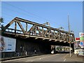
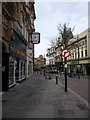
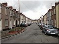
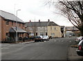
Photos of Victoria Community


Area Information
Victoria Community is a compact civil parish covering exactly one square kilometre in Wales. It is a small, defined locality where the daily rhythm of life is shaped by its limited footprint. Living in this area means navigating a space where every square metre counts. The sheer size suggests a neighbourhood with no room for sprawl, meaning residents likely rely heavily on local amenities and specific transport routes. Because the area is so small, the distance between your home and local services is short, but the capacity for expansion is non-existent. This creates a distinct environment where community interactions are inevitable due to proximity. You can expect a setting that prioritises established routes and existing structures rather than new developments. The historical designation as a parish indicates a long-standing community structure, even if modern population data suggests a different demographic profile. When considering homes in Victoria Community, you are looking at a fully realised urban cell rather than a developing zone. The lack of significant open space constraints means that the built environment dominates the visual landscape. This compactness defines the character of the parish, offering a sense of enclosure rather than the openness found in larger districts.
- Area Type
- Parish
- Area Size
- 1.0 km²
- Population
- Not available
- Population Density
- Not available
Demographics
The population profile within Victoria Community presents a clear picture of an older settlement. The median age stands at 70 years, indicating that the majority of residents are senior citizens. This age distribution suggests a community where leisure activities and services for older adults likely take precedence over amenities targeting younger families. With a median age of 70, you will find that colleagues and neighbours are almost certainly your contemporary age group or older. The specific breakdown of total age data confirms this dominance of the elderly demographic without significant youth populations. Home ownership rates sit at 49%, meaning just under half of the households own their homes outright or with a mortgage. Consequently, nearly half of the residents remain tenants within the civil parish. This balance indicates a mix of people staying through ownership and others who have rented into the area over time. The data provides no further detail on household composition or ethnic diversity, but the high median age is a definitive marker of the community's make-up. For buyers seeking homes in Victoria Community, the environment is tailored towards retirement living rather than child-rearing. You should expect a quiet atmosphere dominated by retirees, which may mean fewer schools or youth-oriented facilities nearby compared to areas with younger populations.
Household Size
Accommodation Type
Tenure
Ethnic Group
Religion
Household Composition
Age
Household Deprivation
NS-SEC
Explore more demographic insights in this area
Go to Demographics tabPlanning
Planning Constraints
- Flood RiskPremium
- Ramsar Wetland SitesPremium
- Area of Outstanding Natural BeautyPremium
- Protected Nature ReservePremium
- Protected WoodlandPremium
- Crime RiskPremium