Area Overview for St. Julians Community
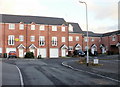
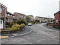
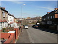
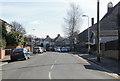
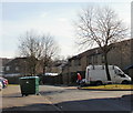
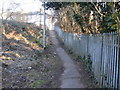
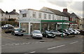
Photos of St. Julians Community

Area Information
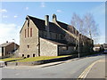
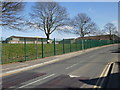
St Julians Community is a civil parish located in Newport, Wales, covering an area of 2.2 km². You will find approximately 4,530 residents living within this defined neighbourhood. The area sits on the east side of Newport and developed significantly during the mid-19th century as the town expanded its population. This growth transformed a settlement of fewer than 1,000 people at the end of the 18th century into a thriving residential zone by 1840. St Julians evolved to serve working-class residents when religious and social institutions deliberately expanded services to exclude them from wealthier parishes. You will encounter St Julian's Church as a central landmark, an original corrugated iron structure from 1891 that now stands as a mix of heritage and suburbia. The parish retains the character of a deliberate urban planning response to historical social concerns. Living here means inhabiting a space that blends 19th-century origins with modern suburban life near the town centre. The proximity to Caerleon and Maindee influences your daily routine and local transport options.
- Area Type
- Parish
- Area Size
- 2.2 km²
- Population
- 4530
- Population Density
- 2070 people/km²
Demographics
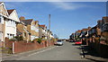
The community currently has a median age of 70 years, indicating a population skewed heavily towards older residents. This age profile suggests a neighbourhood where many homes are occupied by retirees or long-term families. Sixty-seven per cent of households in St Julians Community own their property, which points to a stable, established resident base rather than a transient rental market. You will find that accommodation types reflect this stability, with a high prevalence of owner-occupied dwellings. The ethnic and religious breakdowns do not feature in the available records for this specific parish, so precise diversity figures remain unknown. There is no data provided regarding the distribution of age ranges beyond the median or specific household compositions. Consequently, you cannot determine the exact proportion of children, young families, or students in the area from these statistics alone. The high home ownership rate often correlates with lower levels of perceived deprivation in many parts of the UK, though detailed deprivation indices are not included in the current profile.
Household Size
Accommodation Type
Tenure
Ethnic Group
Religion
Household Composition
Age
Household Deprivation
NS-SEC
Explore more demographic insights in this area
Go to Demographics tabPlanning
Planning Constraints
- Flood RiskPremium
- Ramsar Wetland SitesPremium
- Area of Outstanding Natural BeautyPremium
- Protected Nature ReservePremium
- Protected WoodlandPremium
- Crime RiskPremium