Area Overview for Malpas Community
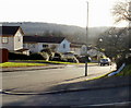
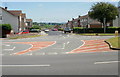
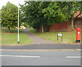
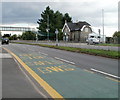
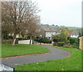
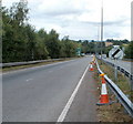
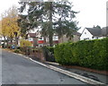
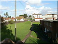
Photos of Malpas Community


Area Information
Living in Malpas Community offers a distinct experience within the city of Newport, South Wales. This civil parish sits on the northern outskirts of the city at approximately 51.6137°N, -3.0050°W. The area covers a total land area of 2.1 km², providing a compact yet established neighbourhood. Historically, Malpas possesses deep roots, featuring a Cluniac priory founded in the reign of Henry I and the historic Malpas Court, once the seat of the Prothero family. By the late 19th century, the location saw rapid development, leading to the construction of Malpas Hall in 1896/7. This building now operates as the Malpas Road Evangelical Church, serving the local population. During the Second World War, Malpas Court was requisitioned as a military headquarters. Today, the Malpas Institute Trust remains active, originating from the sale of a World War I Memorial Institute. Prospective buyers looking for homes in Malpas Community enter a space defined by its blend of historic ecclesiastical buildings and former country estates. The community functions within the Newport City Council electoral district, maintaining a strong connection to both its rural past and its modern urban setting. ### The demographic profile of Malpas Community reveals an older population compared to the national average. The median age for residents stands at 70 years. While the specific most common age range is not itemised beyond the total age statistic, the high median clearly indicates a retired or older demographic. Home ownership is the dominant housing tenure model within the parish. Approximately 75% of residents own their homes outright. This high rate of ownership suggests a stable, settled community rather than a transient rental market. The available data covers total household composition but does not provide a breakdown of single-person versus multi-generational living arrangements. Similarly, while the predominant ethnic group is listed in the dataset, the specific breakdown of ethnicity is not provided in the available figures. Religious affiliation is recorded in the source data, though the specific percentages for major faiths are not detailed. This homogeneity in tenure and age likely shapes the local culture, influencing everything from local shopkeeping to community engagement. ### The property market in Malpas Community is characterised by long-term settlement. With 75% of residents owning their homes, the area functions primarily as an owner-occupied community. This high ownership rate implies that the housing stock is likely comprised of established properties rather than a high turnover of rental units. The civil parish contains a total of 2.1 km² of land, which constrains the total volume of available properties relative to larger districts. Accommodation types generally reflect the historical development of the area, including former country estate homes adapted for other uses and residential conversions of historic buildings. Buyers looking at homes in Malpas Community should expect a market focused on resale rather than new build or short-term lets. The reliance on private ownership also suggests lower pressure for council housing stock within these specific boundaries. For those considering this location, the market dynamics favour stability over speculation. The mix of property types likely ranges from historic residences associated with the Prothero family estate to more standard suburban housing developed as the population grew in the 19th century. ### Digital connectivity is a strong point for residents of Malpas Community, particularly those relying on remote work. The fixed broadband quality score reaches 95 on a scale of 0 to 100. This rating indicates excellent fixed broadband across the parish, ensuring high-speed internet for streaming, working, and education. Mobile network coverage also performs well, with a score of 85 out of 100. This mobile coverage score suggests dependable signal strength for residents managing calls or emergencies while outside their homes. Such infrastructure levels mean that daily internet use is generally seamless for the majority of households. Living in Malpas Community allows residents to enjoy near-prime digital standards. The combination of high fixed and mobile scores reduces the risk of connectivity issues often found in more rural outskirts. For professionals working from home, the Area's 2.1 km² footprint is covered by robust utility provisions. This digital readiness supports the needs of an older demographic who may rely on technology for communication and information access. ### Safety and environmental planning in Malpas Community present a mixed picture for prospective homebuyers. Flood risk assessment passes the safety check with a score of 5.16 on a scale where lower figures indicate less risk. This low flood risk coverage means residents face minimal threat from regular flooding events. The area also passes regarding Ramsar wetland sites and Areas of Outstanding Natural Beauty, with scores of 0, indicating no coverage under these specific planning constraints. However, environmental assessments do raise specific concerns. The parish contains protected nature reserves, which triggers a warning level with a score of 1.63. Additionally, the area contains protected woodland, which also results in a warning level with a score of 3.15. These planning constraints affect development potential and may limit garden expansion or certain building projects near designated zones. Crime risk data is currently only available for areas in England, meaning no specific crime statistics are provided for this Welsh district. The lack of local crime data does not imply an absence of safety information but rather a limitation in the regional reporting system. ### Who constitutes the main population of Malpas Community?The median age of residents in Malpas Community is 70 years. This figure indicates that the area is home to a significantly older demographic than the national average, suggesting it is a popular choice for retired individuals. How strong is the internet connection in the area?Digital infrastructure in Malpas Community is robust. The fixed broadband quality score is 95 out of 100, and the mobile coverage score is 85 out of 100. These high ratings confirm excellent connectivity for working from home. Are there significant environmental restrictions for building in Malpas?Yes, the area contains protected nature reserves and protected woodland. While flood risk is low with a score of 5.16, the presence of these protected sites is registered as a warning level for planning constraints. Potential buyers should check boundaries against these reserves. Is Malpas a renter or owner-occupied area?Malpas Community is primarily an owner-occupied locality. Data shows that 75% of people living in the civil parish own their homes. This high level of home ownership points to a settled, long-term community atmosphere.
- Area Type
- Parish
- Area Size
- 2.1 km²
- Population
- Not available
- Population Density
- Not available
Demographics
The demographic profile of Malpas Community reveals an older population compared to the national average. The median age for residents stands at 70 years. While the specific most common age range is not itemised beyond the total age statistic, the high median clearly indicates a retired or older demographic. Home ownership is the dominant housing tenure model within the parish. Approximately 75% of residents own their homes outright. This high rate of ownership suggests a stable, settled community rather than a transient rental market. The available data covers total household composition but does not provide a breakdown of single-person versus multi-generational living arrangements. Similarly, while the predominant ethnic group is listed in the dataset, the specific breakdown of ethnicity is not provided in the available figures. Religious affiliation is recorded in the source data, though the specific percentages for major faiths are not detailed. This homogeneity in tenure and age likely shapes the local culture, influencing everything from local shopkeeping to community engagement. ### The property market in Malpas Community is characterised by long-term settlement. With 75% of residents owning their homes, the area functions primarily as an owner-occupied community. This high ownership rate implies that the housing stock is likely comprised of established properties rather than a high turnover of rental units. The civil parish contains a total of 2.1 km² of land, which constrains the total volume of available properties relative to larger districts. Accommodation types generally reflect the historical development of the area, including former country estate homes adapted for other uses and residential conversions of historic buildings. Buyers looking at homes in Malpas Community should expect a market focused on resale rather than new build or short-term lets. The reliance on private ownership also suggests lower pressure for council housing stock within these specific boundaries. For those considering this location, the market dynamics favour stability over speculation. The mix of property types likely ranges from historic residences associated with the Prothero family estate to more standard suburban housing developed as the population grew in the 19th century. ### Digital connectivity is a strong point for residents of Malpas Community, particularly those relying on remote work. The fixed broadband quality score reaches 95 on a scale of 0 to 100. This rating indicates excellent fixed broadband across the parish, ensuring high-speed internet for streaming, working, and education. Mobile network coverage also performs well, with a score of 85 out of 100. This mobile coverage score suggests dependable signal strength for residents managing calls or emergencies while outside their homes. Such infrastructure levels mean that daily internet use is generally seamless for the majority of households. Living in Malpas Community allows residents to enjoy near-prime digital standards. The combination of high fixed and mobile scores reduces the risk of connectivity issues often found in more rural outskirts. For professionals working from home, the Area's 2.1 km² footprint is covered by robust utility provisions. This digital readiness supports the needs of an older demographic who may rely on technology for communication and information access. ### Safety and environmental planning in Malpas Community present a mixed picture for prospective homebuyers. Flood risk assessment passes the safety check with a score of 5.16 on a scale where lower figures indicate less risk. This low flood risk coverage means residents face minimal threat from regular flooding events. The area also passes regarding Ramsar wetland sites and Areas of Outstanding Natural Beauty, with scores of 0, indicating no coverage under these specific planning constraints. However, environmental assessments do raise specific concerns. The parish contains protected nature reserves, which triggers a warning level with a score of 1.63. Additionally, the area contains protected woodland, which also results in a warning level with a score of 3.15. These planning constraints affect development potential and may limit garden expansion or certain building projects near designated zones. Crime risk data is currently only available for areas in England, meaning no specific crime statistics are provided for this Welsh district. The lack of local crime data does not imply an absence of safety information but rather a limitation in the regional reporting system. ### Who constitutes the main population of Malpas Community?The median age of residents in Malpas Community is 70 years. This figure indicates that the area is home to a significantly older demographic than the national average, suggesting it is a popular choice for retired individuals. How strong is the internet connection in the area?Digital infrastructure in Malpas Community is robust. The fixed broadband quality score is 95 out of 100, and the mobile coverage score is 85 out of 100. These high ratings confirm excellent connectivity for working from home. Are there significant environmental restrictions for building in Malpas?Yes, the area contains protected nature reserves and protected woodland. While flood risk is low with a score of 5.16, the presence of these protected sites is registered as a warning level for planning constraints. Potential buyers should check boundaries against these reserves. Is Malpas a renter or owner-occupied area?Malpas Community is primarily an owner-occupied locality. Data shows that 75% of people living in the civil parish own their homes. This high level of home ownership points to a settled, long-term community atmosphere.
Household Size
Accommodation Type
Tenure
Ethnic Group
Religion
Household Composition
Age
Household Deprivation
NS-SEC
Explore more demographic insights in this area
Go to Demographics tabPlanning
Planning Constraints
- Flood RiskPremium
- Ramsar Wetland SitesPremium
- Area of Outstanding Natural BeautyPremium
- Protected Nature ReservePremium
- Protected WoodlandPremium
- Crime RiskPremium