Area Overview for Alway Community
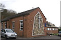
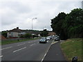
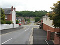
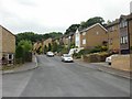
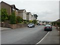
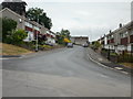
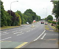
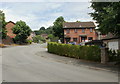
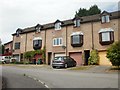
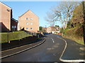
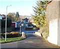
Photos of Alway Community

Area Information
Living in Alway Community means residing in a compact civil parish that spans just 1.8 km². With a population of 1,321 residents, you will find a dense and close-knit settlement where neighbours often know one another well. You are surrounded by a high population density of 748 people per square kilometre, which suggests a vibrant local presence despite the modest footprint. This parish offers a distinct character defined by its concentrated nature, making it easy to access local amenities without needing to travel far for daily essentials. You will experience a lifestyle where the community feel is paramount. The small size of the area ensures that you remain connected to the surrounding Welsh landscape while enjoying the informal social structures of a traditional parish. Life here is characterised by a mix of residential peace and active local involvement. For those seeking a compact living environment where everything is within walking distance, Alway Community delivers. You can anticipate a slower pace of life compared to larger urban centres, yet you will not feel isolated thanks to the significant number of people calling this specific neighbourhood home. The statistics confirm that this is a place where community interaction is not just possible but likely the norm for those calling Alway Community their home.
- Area Type
- Parish
- Area Size
- 1.8 km²
- Population
- 1321
- Population Density
- 748 people/km²
Demographics
The community in Alway Community presents a distinct demographic picture, primarily driven by an older resident population. The median age stands at 70 years, indicating that the majority of your potential neighbours are senior citizens or retired individuals. This age profile suggests a stable environment where households are likely to be quiet and established rather than flowing through with frequent moves. The data identifies the most common age range as simply the total population, reinforcing the idea that the demographic makeup is heavily weighted towards this mature demographic. Home ownership levels stand at 61%, a figure that reflects a significant number of residents owning their residences outright or through mortgage rather than renting. This high rate of ownership typically points to long-term stability within the area. When you consider the household composition and accommodation types, the picture aligns with a community of settled families and retirees. The predominance of older residents means you will find an atmosphere geared towards retirement living. There is no indication of a young, transient workforce dominating the streets. Instead, you will encounter a settled community where many locals have called Alway Community home for decades. The demographic reality is one of maturity, with home ownership serving as the cornerstone of local stability.
Household Size
Accommodation Type
Tenure
Ethnic Group
Religion
Household Composition
Age
Household Deprivation
NS-SEC
Explore more demographic insights in this area
Go to Demographics tabPlanning
Planning Constraints
- Flood RiskPremium
- Ramsar Wetland SitesPremium
- Area of Outstanding Natural BeautyPremium
- Protected Nature ReservePremium
- Protected WoodlandPremium
- Crime RiskPremium