Area Overview for Graig Community
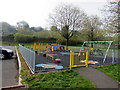
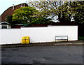
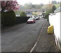
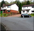
Photos of Graig Community
Area Information
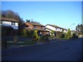
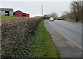
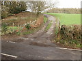
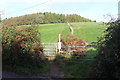
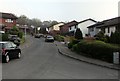
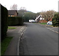
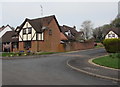
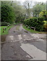
Graig Community sits at the southern edge of the city of Newport in South Wales. This unitary electoral division covers a total area of 14.0 square kilometres, encompassing the historical wards of Lower Machen, Rhiwderin, and Bassaleg. Approximately 6,000 residents currently call this space home within the Graig Community Council area. The geographical boundaries are defined by the Ebbw River to the north and the M4 motorway to the south. The community extends far beyond these official limits, with the wider neighbourhood containing around 3,500 homes and over 6,000 residents in total. Living in Graig Community offers proximity to significant transport links, including the M4 motorway which borders the area directly. A railway station is situated at Rhiwderin, providing access to the wider network. You will find established infrastructure supporting daily life, such as the historic Rhiwderin Community Centre and the Graig Community Centre built in Bassaleg in 1985. The area has a deep history, with the community council tracing its roots back to a parish council established in December 1894. You are living in a place where modern connectivity meets long-standing local institutions.
- Area Type
- Parish
- Area Size
- 14.0 km²
- Population
- 1324
- Population Density
- 95 people/km²
Demographics
The population of Graig Community reflects a settled, established community. The median age for residents stands at 70 years, indicating a demographic heavily skewed towards older adults. This age profile suggests the area is popular with retirees or those seeking a quiet retirement environment. Home ownership is the dominant living arrangement, with 80% of households owning their properties outright or with a mortgage. You are looking at an area where financial stability regarding housing is common among residents. The community is largely homogeneous in terms of household composition and accommodation types, though specific breakdowns by type are not fully detailed in current records. You can expect a neighbourhood where family structures tend to be stable. The low population density of 95 people per square kilometre means you will likely find more green space and less crowding than in urban Newport. Living in Graig Community offers a pace of life suited to those who prefer a lower population density. The high rate of home ownership contrasts with areas where renting is the primary mode of accommodation.
Household Size
Accommodation Type
Tenure
Ethnic Group
Religion
Household Composition
Age
Household Deprivation
NS-SEC
Explore more demographic insights in this area
Go to Demographics tabPlanning
Planning Constraints
- Flood RiskPremium
- Ramsar Wetland SitesPremium
- Area of Outstanding Natural BeautyPremium
- Protected Nature ReservePremium
- Protected WoodlandPremium
- Crime RiskPremium