Area Overview for SA8 3XZ
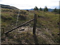
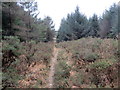
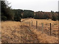
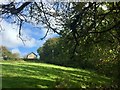
Photos of SA8 3XZ


Area Information
Living in SA8 3XZ places you within a specific postcode area covering a small residential cluster in Wales. This district is defined by its compact nature and a population of 1374 residents. The area offers a quiet retreat, distinct from the larger urban centres nearby. You are in a setting where the community is close-knit, supported by a population density of 88 people per square kilometre. This figure suggests a moderate spread of housing without the pressure of high-density living. The location provides a stable environment where neighbours know one another, yet everyone enjoys sufficient space. It is a place where daily life revolves around town centres and transport links rather than urban sprawl. Residents appreciate the balance between privacy and access to services. The area serves as a practical base for those who want predictable routines and established neighbourhood values. You find a community that supports long-term living without the noise and congestion often found in major cities. This postcode represents a slice of Welsh life that values stability and predictable surroundings.
- Area Type
- Postcode
- Area Size
- Not available
- Population
- 1374
- Population Density
- 88 people/km²
The property market in SA8 3XZ is characterised by a strong preference for single-family homes. Houses dominate the local housing stock, reflecting the tastes of the area's 78% home ownership rate. This statistic indicates that the area is primarily owner-occupied rather than a rental market. You are unlikely to find large blocks of flats or purpose-built apartments within this specific cluster. Instead, the streets are lined with detached or semi-detached properties suited for families and established adults. This type of housing stock appeals to buyers who value space, gardens, and traditional neighbourhood settings. The high percentage of owner-occupiers means the local estate values remain relatively stable without the volatility seen in high-turnover rental districts. When you look around SA8 3XZ, you see a market driven by long-term residents who have invested in their properties. This dynamic creates a sense of exclusivity within a small footprint, where property values are supported by a desire for permanence and a house in the ground.
House Prices in SA8 3XZ
No properties found in this postcode.
Energy Efficiency in SA8 3XZ
Residents of SA8 3XZ enjoy convenient access to a variety of retail and transport amenities within practical reach. There are five key retail locations nearby, including Morrisons Daily, Lidl Pontardawe, and Tesco Swansea. These supermarkets provide all your essential shopping needs for daily groceries and household essentials. You also have excellent transport options with four railway stations available to you. Neath Railway Station, Skewen Railway Station, and Llansamlet Railway Station offer connections to wider networks. This blend of local convenience and regional connectivity means you do not need to travel far for most tasks. The presence of major supermarkets like Tesco ensures you have access to national chains for special occasions or bulk shopping. Meanwhile, local stores like Morrisons Daily offer fresh produce and everyday items for quick trips. This accessibility allows you to maintain a comfortable lifestyle without the pressure of city centre commuting.
Amenities
Schools
Families living in SA8 3XZ have access to Rhos Primary School for their children. This institution is the key educational provision listed for the immediate vicinity of the postcode. The school classification as an "other" type suggests it serves the primary education needs of the local catchment. You do not have data on secondary schools or independent options directly attached to this specific cluster, but Rhos Primary provides the foundational education for neighbourhood children. The presence of this single named institution indicates a focused approach to schooling where families rely on one central facility. Prospective homebuyers should consider the proximity to Rhos Primary when evaluating homes in SA8 3XZ. The school's role is central to the community fabric, supporting children from the age group that dominates the local population. Although there are no other specific schools named in the available records, the area provides a clear educational anchor for its residents.
| Rank | School | Type | Entry gender | Ages |
|---|
Explore more schools in this area
Go to Schools tabDemographics
The community in SA8 3XZ reflects a settled population with a median age of 47 years. Most residents fall into the adults aged 30 to 64 years age range, indicating a predominantly working-age demographic. Three-quarters of the households own their homes, meaning 78% of residents are owners-occupiers. This level of tenure suggests long-standing families and stability within the local neighbourhood. You will find that the local housing stock consists primarily of houses rather than flats or high-density blocks. The predominant ethnic group is White, which aligns with the wider demographic trends of the Swansea region. This homogeneity contributes to a consistent community character where residents share similar backgrounds. The lack of significant rental market penetration means you are looking at a neighbourly environment built around permanence. These figures illustrate an area where families have taken root and intend to stay for the long term.
Household Size
Accommodation Type
Tenure
Ethnic Group
Religion
Household Composition
Age
Household Deprivation
NS-SEC
Explore more demographic insights in this area
Go to Demographics tabPlanning
Planning Constraints
- Flood RiskPremium
- Ramsar Wetland SitesPremium
- Area of Outstanding Natural BeautyPremium
- Protected Nature ReservePremium
- Protected WoodlandPremium
- Crime RiskPremium