Area Overview for SA8 3EH
Photos of SA8 3EH
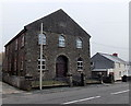
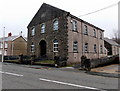
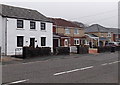
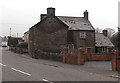
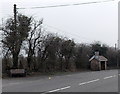
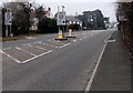
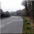
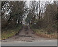
13 photos from this area
Area Information
Key information about the SA8 3EH including its size, population, and administrative classification.
- Area Type
- Postcode
- Area Size
- 1.8 hectares
- Population
- 1186
- Population Density
- 1994 people/km²
House Prices in SA8 3EH
35
Properties
£188,133
Average Sold Price
£36,000
Lowest Price
£600,000
Highest Price
Showing 35 properties
| Address | Type | Beds | Baths | Last Sale Price | Last Sale Date | |
|---|---|---|---|---|---|---|
| 91 Neath Road, Rhos, Pontardawe, SA8 3EH | Retail | 4 | 5 | £327,000 | Oct 2022 | |
| 113 Neath Road, Rhos, Pontardawe, SA8 3EH | house | 2 | 1 | £600,000 | Jun 2021 | |
| 107 Neath Road, Rhos, Pontardawe, SA8 3EH | house | - | - | £220,000 | Jun 2021 | |
| 97 Neath Road, Rhos, Pontardawe, SA8 3EH | Semi-detached | 3 | 1 | £140,000 | Apr 2021 | |
| The Sanctuary, 81 Neath Road, Rhos, Pontardawe, SA8 3EH | Detached | 3 | 1 | £320,000 | Nov 2020 | |
| 99 Neath Road, Pontardawe, Swansea, SA8 3EH | Semi-detached | 3 | 1 | £170,000 | Oct 2020 | |
| 87 Neath Road, Rhos, Pontardawe, SA8 3EH | Detached | 3 | 1 | £272,000 | Feb 2020 | |
| 101 Neath Road, Rhos, Pontardawe, SA8 3EH | Semi-detached | 3 | 1 | £116,500 | Feb 2016 | |
| 79 Neath Road, Rhos, Pontardawe, SA8 3EH | Bungalow | 2 | 1 | £140,000 | Sep 2015 | |
| 95 Neath Road, Rhos, Pontardawe, SA8 3EH | house | 3 | - | £122,500 | Jun 2011 |
Page 1 of 4
Energy Efficiency in SA8 3EH
Amenities
Schools
| Rank | School | Type | Entry gender | Ages |
|---|
Explore more schools in this area
Go to Schools tabDemographics
Household Size
Two person
most common
Accommodation Type
Houses
most common
Tenure
91
majority
Ethnic Group
White
most common
Religion
N/A
most common
Household Composition
N/A
most common
Age
47
median
Adults (30-64 years)
most common
Household Deprivation
N/A
with no deprivation
NS-SEC
36
in Lower managerial occupations
Explore more demographic insights in this area
Go to Demographics tabPlanning
Planning Constraints
- Flood RiskPremium
- Ramsar Wetland SitesPremium
- Area of Outstanding Natural BeautyPremium
- Protected Nature ReservePremium
- Protected WoodlandPremium
- Crime RiskPremium