Area Overview for SA18 1EH
Photos of SA18 1EH
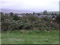
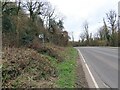
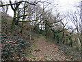

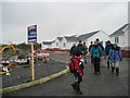
9 photos from this area
Area Information
Key information about the SA18 1EH including its size, population, and administrative classification.
- Area Type
- Postcode
- Area Size
- 11.7 hectares
- Population
- 1597
- Population Density
- 856 people/km²
House Prices in SA18 1EH
12
Properties
£136,800
Average Sold Price
£29,000
Lowest Price
£230,000
Highest Price
Showing 12 properties
| Address | Type | Beds | Baths | Last Sale Price | Last Sale Date | |
|---|---|---|---|---|---|---|
| Pen Y Bryn, 51 Graig Road, Gwaun Cae Gurwen, SA18 1EH | house | - | - | £230,000 | Sep 2023 | |
| 40 Graig Road, Gwaun Cae Gurwen, SA18 1EH | Detached | 3 | 2 | £170,000 | Dec 2020 | |
| Graiglea, 43 Graig Road, Gwaun Cae Gurwen, SA18 1EH | house | - | - | £200,000 | Jan 2017 | |
| 41 Graig Road, Gwaun Cae Gurwen, SA18 1EH | Detached | - | - | £55,000 | May 2005 | |
| Tanyrallt, Graig Road, Gwaun Cae Gurwen, SA18 1EH | Detached | - | - | £29,000 | Jul 1997 | |
| Bryneron, Graig Road, Gwaun Cae Gurwen, SA18 1EH | Detached | - | - | - | - | |
| Cwmdrysien Farm, Graig Road, Gwaun Cae Gurwen, SA18 1EH | Farm | - | - | - | - | |
| Cwmdrysien Farmhouse, Cwmdrysien Farm, Graig Road, Gwaun Cae Gurwen, SA18 1EH | Detached | - | - | - | - | |
| 47 Graig Road, Gwaun Cae Gurwen, SA18 1EH | Detached | - | - | - | - | |
| Pen-y-cwm, 49 Graig Road, Gwaun Cae Gurwen, SA18 1EH | Bungalow | - | - | - | - |
Page 1 of 2
Energy Efficiency in SA18 1EH
Amenities
Schools
| Rank | School | Type | Entry gender | Ages |
|---|
Explore more schools in this area
Go to Schools tabDemographics
Household Size
Two person
most common
Accommodation Type
Houses
most common
Tenure
68
majority
Ethnic Group
White
most common
Religion
N/A
most common
Household Composition
N/A
most common
Age
47
median
Adults (30-64 years)
most common
Household Deprivation
N/A
with no deprivation
NS-SEC
23
in Lower managerial occupations
Explore more demographic insights in this area
Go to Demographics tabPlanning
Planning Constraints
- Flood RiskPremium
- Ramsar Wetland SitesPremium
- Area of Outstanding Natural BeautyPremium
- Protected Nature ReservePremium
- Protected WoodlandPremium
- Crime RiskPremium