Area Overview for SA13 3ET
Photos of SA13 3ET
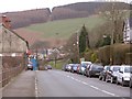
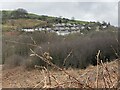
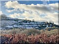
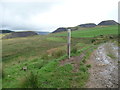
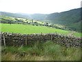
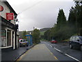
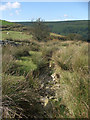
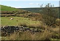
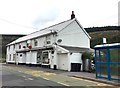
19 photos from this area
Area Information
Key information about the SA13 3ET including its size, population, and administrative classification.
- Area Type
- Postcode
- Area Size
- 41.6 hectares
- Population
- 2136
- Population Density
- 52 people/km²
House Prices in SA13 3ET
20
Properties
£102,850
Average Sold Price
£12,000
Lowest Price
£220,000
Highest Price
Showing 20 properties
| Address | Type | Beds | Baths | Last Sale Price | Last Sale Date | |
|---|---|---|---|---|---|---|
| 49 Afan Road, Duffryn Rhondda, SA13 3ET | Semi-detached | 3 | 1 | £101,500 | Mar 2018 | |
| 39 Afan Road, Duffryn Rhondda, SA13 3ET | Semi-detached | 4 | - | £152,000 | Jan 2016 | |
| 40 Afan Road, Duffryn Rhondda, SA13 3ET | Semi-detached | 3 | - | £108,000 | Oct 2015 | |
| 45 Afan Road, Duffryn Rhondda, SA13 3ET | Semi-detached | 4 | 1 | £71,000 | Feb 2013 | |
| 52 Afan Road, Duffryn Rhondda, SA13 3ET | Detached | - | - | £215,000 | Mar 2007 | |
| 51 Afan Road, Duffryn Rhondda, SA13 3ET | Detached | - | - | £220,000 | Jun 2006 | |
| 44 Afan Road, Duffryn Rhondda, SA13 3ET | Semi-detached | 3 | - | £63,000 | Dec 2003 | |
| 43 Afan Road, Duffryn Rhondda, SA13 3ET | Semi-detached | - | - | £39,000 | Nov 1998 | |
| 41 Afan Road, Duffryn Rhondda, SA13 3ET | house | - | - | £12,000 | May 1996 | |
| 38 Afan Road, Duffryn Rhondda, SA13 3ET | Semi-detached | - | - | £47,000 | Jan 1995 |
Page 1 of 2
Energy Efficiency in SA13 3ET
Amenities
Schools
| Rank | School | Type | Entry gender | Ages |
|---|
Explore more schools in this area
Go to Schools tabDemographics
Household Size
Two person
most common
Accommodation Type
Houses
most common
Tenure
72
majority
Ethnic Group
White
most common
Religion
N/A
most common
Household Composition
N/A
most common
Age
47
median
Adults (30-64 years)
most common
Household Deprivation
N/A
with no deprivation
NS-SEC
18
in Lower managerial occupations
Explore more demographic insights in this area
Go to Demographics tabPlanning
Planning Constraints
- Flood RiskPremium
- Ramsar Wetland SitesPremium
- Area of Outstanding Natural BeautyPremium
- Protected Nature ReservePremium
- Protected WoodlandPremium
- Crime RiskPremium