Area Overview for SA13 2PW
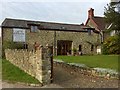
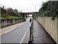
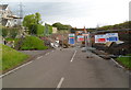
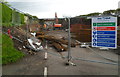
Photos of SA13 2PW


Area Information
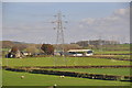
Living in SA13 2PW offers a quiet residential experience within the Welsh postcode area. This specific cluster covers a small residential zone with a total population of 1,984 people. The area sits at a population density of 47 per square kilometre, meaning residents enjoy spacious surroundings rather than dense urban living. The location appeals to those seeking a less crowded environment while remaining connected to essential services. You will find that daily life here is characterised by a strong sense of established community and low population pressure. The demographic profile indicates a mature neighbourhood where families and older residents coexist peacefully. This postcode represents a stable pocket of homes within a larger local context. The scale of the area keeps quiet and is managed through typical sub-provincial Welsh infrastructure. When considering SA13 2PW, you are looking at a place defined by its moderate size and manageable population metrics. The area serves as a functional living space for over one thousand households without the noise or congestion of larger towns. It stands as a practical choice for buyers who prioritise space and tranquility over urban convenience. The specific nature of being a postcode area ensures a tight-knit feel without sacrificing proximity to wider regional centres.
- Area Type
- Postcode
- Area Size
- Not available
- Population
- 1984
- Population Density
- 47 people/km²
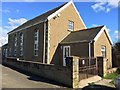
The housing stock in SA13 2PW is defined by a clear predominance of houses rather than flats or apartments. With a home ownership rate of 89%, the market functions primarily as an owner-occupied sector rather than a vibrant rental landscape. This statistic indicates that most transactions involve existing owners moving between properties rather than landlords seeking new tenants. You will find that the available homes in SA13 2PW are almost certainly detached or semi-detached structures suited to family living or downsizing needs. The type of accommodation excludes purpose-built rental blocks, solidifying the area's status as a enclave of single-family residences. This market dynamic suggests that buyer demand focuses on acquisition rather than lease agreements. The lack of rental inventory means you will not encounter a transient population or short-term let options. Properties here are likely viewed as permanent assets, which often correlates with better maintenance and longer-term care for the streetscape. The specific composition of the housing stock limits the variety of home types available, as flats are not a recorded feature of this postcode. For a buyer seeking a traditional house, SA13 2PW presents a straightforward environment where ownership is the norm. The consistent accommodation type ensures that expectations regarding garden space, parking, and interior layout remain predictable across the neighbourhood.
House Prices in SA13 2PW
No properties found in this postcode.
Energy Efficiency in SA13 2PW
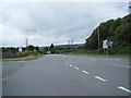
Residents of SA13 2PW enjoy convenient access to a range of retail and transport amenities within practical reach. Five retail locations serve the immediate neighbourhood, providing essential shopping capabilities without requiring a long drive. Notable supermarkets include Tesco North, Asda Pyle, and Morrisons Daily, giving you three major chains to choose from for groceries and household needs. This retail presence reduces the need to travel far for basic provisions, adding a layer of independence to your daily routine. Transport links are equally accessible, with five railway stations available nearby. You can travel from Pyle Railway Station, Port Talbot Parkway Railway Station, or Garth Railway Station depending on your direction of travel. These stations provide the rail connectivity necessary for business trips or leisure visits without owning a car as a strict requirement. The proximity to these stations means you maintain an urban escape without leaving the residential character of the postcode. The blend of supermarket convenience and rail access defines the lifestyle here as one of suburban ease. You can fill your fridge with a quick stop at Tesco or Asda before commencing a journey from the nearest station to work or recreation. This balance keeps daily life efficient and grounded in the practicalities of modern living.
Amenities
Schools
Families in SA13 2PW have access to four specific educational institutions within their local catchment or immediate vicinity. The list of nearby schools includes Groes Primary School and Coed Hirwaun Primary School, both operating as maintained primary establishments. Secondary education options are represented by Dyffryn School and Ysgol Cwm Brombil. While specific Ofsted ratings and detailed academic performance data are not included in the current records, the presence of these institutions confirms established educational provision for the area. The mix of primary and secondary schools suggests that children in the community attend different facilities depending on their age and educational stage. You will not find comprehensive academic league tables attached to these names in the standard dataset, but the structure of the school list indicates a functional local education system. Residents should contact the individual schools directly for up-to-date grading information and admissions criteria. The proximity of four schools to the postcode ensures that educational needs are met without excessive travel times for local children. The names Coed Hirwaun and Cwm Brombil reflect the local geography and heritage often found in school names across the Vale of Neath. Prospective parents should verify transport links to specific schools, as the nearest options are listed as practical choices for families residing in this Welsh residential cluster. The availability of both primary and secondary venues provides continuity for students growing up in SA13 2PW.
| Rank | School | Type | Entry gender | Ages |
|---|
Explore more schools in this area
Go to Schools tabDemographics
The community in SA13 2PW reflects a mature demographic profile with a median age of 47 years. Most residents fall within the 30 to 64 years age range, indicating a population composed primarily of working-age adults and retirees. This age distribution suggests a neighbourhood that values stability and long-term settlement. Home ownership stands at a high level of 89%, revealing that the vast majority of property owners have established roots in their current homes. Accommodation types are exclusively houses, which aligns with the older, family-oriented demographic structure found throughout this part of Wales. Ethnic diversity shows a predominant White population, consistent with the broader regional average for rural and semi-rural Welsh settlements. The high rate of home ownership implies strong attachment to the locality and a market driven by existing rather than transient residents. With a median age approaching mid-forty, you will encounter a community where life stages have stabilised and long-term plans take precedence over frequent moves. The lack of rental housing dominance further isolates this area as a destination for those planning to stay for the long haul. This demographic concentration creates a predictable and settled atmosphere where neighbours have likely shared their address for decades. Buyers should expect a community where established patterns of life dominate the social fabric.
Household Size
Accommodation Type
Tenure
Ethnic Group
Religion
Household Composition
Age
Household Deprivation
NS-SEC
Explore more demographic insights in this area
Go to Demographics tabPlanning
Planning Constraints
- Flood RiskPremium
- Ramsar Wetland SitesPremium
- Area of Outstanding Natural BeautyPremium
- Protected Nature ReservePremium
- Protected WoodlandPremium
- Crime RiskPremium