Area Overview for SA13 2LH
Photos of SA13 2LH
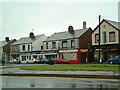
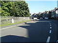
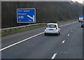
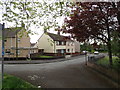
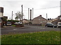
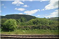
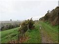
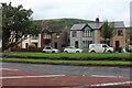
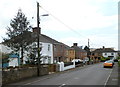
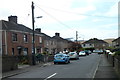
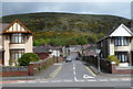
46 photos from this area
Area Information
Key information about the SA13 2LH including its size, population, and administrative classification.
- Area Type
- Postcode
- Area Size
- 4059 m²
- Population
- 1967
- Population Density
- 4382 people/km²
House Prices in SA13 2LH
15
Properties
£83,910
Average Sold Price
£41,500
Lowest Price
£159,000
Highest Price
Showing 15 properties
| Address | Type | Beds | Baths | Last Sale Price | Last Sale Date | |
|---|---|---|---|---|---|---|
| 6 Graig Avenue, Margam, SA13 2LH | Semi-detached | 3 | 1 | £159,000 | Aug 2023 | |
| 14 Graig Avenue, Margam, SA13 2LH | Semi-detached | 3 | 1 | £114,000 | Mar 2020 | |
| 5 Graig Avenue, Margam, SA13 2LH | Semi-detached | 3 | 1 | £118,000 | Aug 2019 | |
| 3 Graig Avenue, Margam, SA13 2LH | Semi-detached | 3 | 1 | £97,000 | Jun 2019 | |
| 8 Graig Avenue, Margam, SA13 2LH | Semi-detached | 3 | 1 | £76,000 | Jan 2019 | |
| 4 Graig Avenue, Margam, SA13 2LH | Semi-detached | 3 | 1 | £75,000 | Mar 2015 | |
| 2 Graig Avenue, Margam, SA13 2LH | Semi-detached | 3 | 1 | £63,000 | May 2014 | |
| 1 Graig Avenue, Margam, SA13 2LH | house | - | - | £54,000 | Oct 2003 | |
| 16 Graig Avenue, Margam, SA13 2LH | Semi-detached | - | - | £41,595 | Mar 1999 | |
| 9 Graig Avenue, Margam, SA13 2LH | Semi-detached | 3 | 1 | £41,500 | Apr 1996 |
Page 1 of 2
Energy Efficiency in SA13 2LH
Amenities
Schools
| Rank | School | Type | Entry gender | Ages |
|---|
Explore more schools in this area
Go to Schools tabDemographics
Household Size
Two person
most common
Accommodation Type
Houses
most common
Tenure
67
majority
Ethnic Group
White
most common
Religion
N/A
most common
Household Composition
N/A
most common
Age
47
median
Adults (30-64 years)
most common
Household Deprivation
N/A
with no deprivation
NS-SEC
24
in Lower managerial occupations
Explore more demographic insights in this area
Go to Demographics tabPlanning
Planning Constraints
- Flood RiskPremium
- Ramsar Wetland SitesPremium
- Area of Outstanding Natural BeautyPremium
- Protected Nature ReservePremium
- Protected WoodlandPremium
- Crime RiskPremium