Area Overview for SA13 2EG
Photos of SA13 2EG
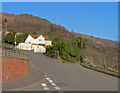

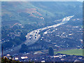
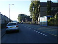

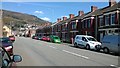
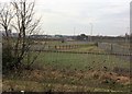
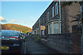
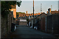
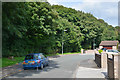
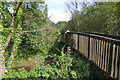
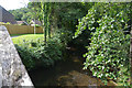
62 photos from this area
Area Information
Key information about the SA13 2EG including its size, population, and administrative classification.
- Area Type
- Postcode
- Area Size
- 3.8 hectares
- Population
- 1322
- Population Density
- 454 people/km²
House Prices in SA13 2EG
25
Properties
£185,938
Average Sold Price
£85,000
Lowest Price
£285,000
Highest Price
Showing 25 properties
| Address | Type | Beds | Baths | Last Sale Price | Last Sale Date | |
|---|---|---|---|---|---|---|
| 115 Pen Y Cae Road, Port Talbot, SA13 2EG | Flat | - | - | £265,000 | Dec 2021 | |
| 117A Pen Y Cae Road, Port Talbot, SA13 2EG | Detached | 6 | 1 | £160,000 | Dec 2018 | |
| 95 Pen Y Cae Road, Port Talbot, SA13 2EG | Semi-detached | 4 | 1 | £190,000 | May 2017 | |
| 113 Pen Y Cae Road, Port Talbot, SA13 2EG | Detached | 4 | 2 | £240,000 | Aug 2016 | |
| 105 Pen Y Cae Road, Port Talbot, SA13 2EG | Bungalow | 2 | 1 | £115,000 | Aug 2010 | |
| 107 Pen Y Cae Road, Port Talbot, SA13 2EG | Detached | - | - | £147,500 | Sep 2008 | |
| 117 Pen Y Cae Road, Port Talbot, SA13 2EG | Detached | - | - | £285,000 | Feb 2008 | |
| 99 Pen Y Cae Road, Port Talbot, SA13 2EG | house | 4 | - | £85,000 | Aug 2004 | |
| Maes Y Bryn Residential Home, 119 Pen Y Cae Road, Port Talbot, SA13 2EG | hotel | - | - | - | - | |
| 109 Pen Y Cae Road, Port Talbot, SA13 2EG | Semi-detached | 3 | 1 | - | - |
Page 1 of 3
Energy Efficiency in SA13 2EG
Amenities
Schools
| Rank | School | Type | Entry gender | Ages |
|---|
Explore more schools in this area
Go to Schools tabDemographics
Household Size
Two person
most common
Accommodation Type
Houses
most common
Tenure
83
majority
Ethnic Group
White
most common
Religion
N/A
most common
Household Composition
N/A
most common
Age
47
median
Adults (30-64 years)
most common
Household Deprivation
N/A
with no deprivation
NS-SEC
29
in Lower managerial occupations
Explore more demographic insights in this area
Go to Demographics tabPlanning
Planning Constraints
- Flood RiskPremium
- Ramsar Wetland SitesPremium
- Area of Outstanding Natural BeautyPremium
- Protected Nature ReservePremium
- Protected WoodlandPremium
- Crime RiskPremium