Area Overview for SA13 2DJ
Photos of SA13 2DJ
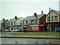
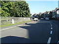
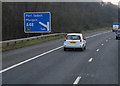
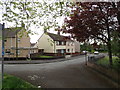
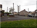
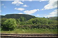
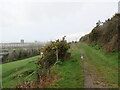
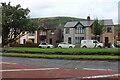
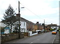
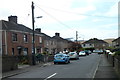
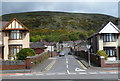
46 photos from this area
Area Information
Key information about the SA13 2DJ including its size, population, and administrative classification.
- Area Type
- Postcode
- Area Size
- 3.2 hectares
- Population
- 1967
- Population Density
- 4382 people/km²
House Prices in SA13 2DJ
47
Properties
£63,085
Average Sold Price
£42,500
Lowest Price
£99,950
Highest Price
Showing 47 properties
| Address | Type | Beds | Baths | Last Sale Price | Last Sale Date | |
|---|---|---|---|---|---|---|
| 34 Pant Celydd, Margam, SA13 2DJ | Terraced | 3 | 1 | £99,950 | Jan 2021 | |
| 19 Pant Celydd, Margam, SA13 2DJ | Terraced | 3 | 1 | £83,000 | Jun 2018 | |
| 35 Pant Celydd, Margam, SA13 2DJ | Semi-detached | 3 | 1 | £75,000 | Mar 2018 | |
| 29 Pant Celydd, Margam, SA13 2DJ | Terraced | 2 | 1 | £63,000 | Apr 2014 | |
| 30 Pant Celydd, Margam, SA13 2DJ | house | - | - | £45,000 | Apr 2013 | |
| 31 Pant Celydd, Margam, SA13 2DJ | house | - | - | £45,000 | Apr 2013 | |
| 36 Pant Celydd, Margam, SA13 2DJ | house | - | - | £45,000 | Apr 2013 | |
| 32 Pant Celydd, Margam, SA13 2DJ | house | - | - | £45,000 | Apr 2011 | |
| 26 Pant Celydd, Margam, SA13 2DJ | house | - | - | £45,000 | Apr 2011 | |
| 27 Pant Celydd, Margam, SA13 2DJ | house | - | - | £62,000 | Feb 2010 |
Page 1 of 5
Energy Efficiency in SA13 2DJ
Amenities
Schools
| Rank | School | Type | Entry gender | Ages |
|---|
Explore more schools in this area
Go to Schools tabDemographics
Household Size
Two person
most common
Accommodation Type
Houses
most common
Tenure
67
majority
Ethnic Group
White
most common
Religion
N/A
most common
Household Composition
N/A
most common
Age
47
median
Adults (30-64 years)
most common
Household Deprivation
N/A
with no deprivation
NS-SEC
24
in Lower managerial occupations
Explore more demographic insights in this area
Go to Demographics tabPlanning
Planning Constraints
- Flood RiskPremium
- Ramsar Wetland SitesPremium
- Area of Outstanding Natural BeautyPremium
- Protected Nature ReservePremium
- Protected WoodlandPremium
- Crime RiskPremium