Area Overview for SA13 1EE
Photos of SA13 1EE
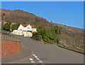

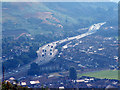


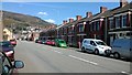


62 photos from this area
Area Information
Key information about the SA13 1EE including its size, population, and administrative classification.
- Area Type
- Postcode
- Area Size
- 1.6 hectares
- Population
- 1794
- Population Density
- 5284 people/km²
House Prices in SA13 1EE
49
Properties
£86,225
Average Sold Price
£30,000
Lowest Price
£180,000
Highest Price
Showing 49 properties
| Address | Type | Beds | Baths | Last Sale Price | Last Sale Date | |
|---|---|---|---|---|---|---|
| 38 Tan Y Groes Street, Port Talbot, SA13 1EE | Terraced | 6 | 3 | £180,000 | Jul 2025 | |
| 46 Tan Y Groes Street, Port Talbot, SA13 1EE | Terraced | 3 | 1 | £178,500 | Mar 2024 | |
| 54 Tan Y Groes Street, Port Talbot, SA13 1EE | house | - | - | £133,500 | Aug 2021 | |
| 102 Tan Y Groes Street, Port Talbot, SA13 1EE | house | - | - | £155,000 | Jul 2021 | |
| 80 Tan Y Groes Street, Port Talbot, SA13 1EE | house | - | - | £155,000 | Feb 2021 | |
| 128 Tan Y Groes Street, Port Talbot, SA13 1EE | Terraced | 3 | 1 | £128,000 | Aug 2019 | |
| 40A Tan Y Groes Street, Port Talbot, SA13 1EE | Terraced | 1 | 1 | £50,000 | May 2017 | |
| 50 Tan Y Groes Street, Port Talbot, SA13 1EE | Terraced | 3 | 1 | £65,000 | Apr 2016 | |
| 68 Tan Y Groes Street, Port Talbot, SA13 1EE | Terraced | - | - | £69,000 | Dec 2015 | |
| 66 Tan Y Groes Street, Port Talbot, SA13 1EE | Terraced | 3 | - | £111,000 | Aug 2014 |
Page 1 of 5
Energy Efficiency in SA13 1EE
Amenities
Schools
| Rank | School | Type | Entry gender | Ages |
|---|
Explore more schools in this area
Go to Schools tabDemographics
Household Size
One person
most common
Accommodation Type
Houses
most common
Tenure
55
majority
Ethnic Group
White
most common
Religion
N/A
most common
Household Composition
N/A
most common
Age
47
median
Adults (30-64 years)
most common
Household Deprivation
N/A
with no deprivation
NS-SEC
23
in Lower managerial occupations
Explore more demographic insights in this area
Go to Demographics tabPlanning
Planning Constraints
- Flood RiskPremium
- Ramsar Wetland SitesPremium
- Area of Outstanding Natural BeautyPremium
- Protected Nature ReservePremium
- Protected WoodlandPremium
- Crime RiskPremium