Area Overview for SA12 9RP
Photos of SA12 9RP
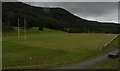
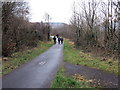
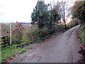
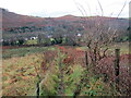
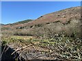
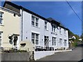
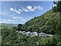
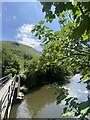
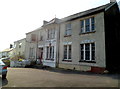
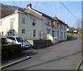
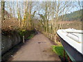
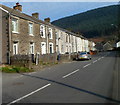
38 photos from this area
Area Information
Key information about the SA12 9RP including its size, population, and administrative classification.
- Area Type
- Postcode
- Area Size
- 38.9 hectares
- Population
- 1462
- Population Density
- 84 people/km²
House Prices in SA12 9RP
19
Properties
£78,188
Average Sold Price
£45,000
Lowest Price
£150,000
Highest Price
Showing 19 properties
| Address | Type | Beds | Baths | Last Sale Price | Last Sale Date | |
|---|---|---|---|---|---|---|
| Maes Yr Afon, 9 Danybont, Pontrhydyfen, SA12 9RP | Semi-detached | - | - | £150,000 | May 2014 | |
| 1 Danybont, Pontrhydyfen, SA12 9RP | house | - | - | £110,500 | Aug 2010 | |
| 17 Danybont, Pontrhydyfen, SA12 9RP | Semi-detached | - | - | £45,000 | Jun 2008 | |
| 10 Danybont, Pontrhydyfen, SA12 9RP | Semi-detached | - | - | £48,000 | Dec 2000 | |
| Bowness, 18 Danybont, Pontrhydyfen, SA12 9RP | Detached | - | - | £72,000 | Oct 1999 | |
| Cruglas, 8 Danybont, Pontrhydyfen, SA12 9RP | Semi-detached | - | - | £47,000 | Mar 1999 | |
| 11 Danybont, Pontrhydyfen, SA12 9RP | Semi-detached | - | - | £68,000 | Dec 1997 | |
| Torlan, Danybont, Pontrhydyfen, SA12 9RP | Detached | - | - | £85,000 | Dec 1997 | |
| Swn Y Dwr, 3 Danybont, Pontrhydyfen, SA12 9RP | Detached | 3 | - | - | - | |
| The Barracks, 19 Danybont, Pontrhydyfen, SA12 9RP | Detached | - | - | - | - |
Page 1 of 2
Energy Efficiency in SA12 9RP
Amenities
Schools
| Rank | School | Type | Entry gender | Ages |
|---|
Explore more schools in this area
Go to Schools tabDemographics
Household Size
Two person
most common
Accommodation Type
Houses
most common
Tenure
78
majority
Ethnic Group
White
most common
Religion
N/A
most common
Household Composition
N/A
most common
Age
47
median
Adults (30-64 years)
most common
Household Deprivation
N/A
with no deprivation
NS-SEC
28
in Lower managerial occupations
Explore more demographic insights in this area
Go to Demographics tabPlanning
Planning Constraints
- Flood RiskPremium
- Ramsar Wetland SitesPremium
- Area of Outstanding Natural BeautyPremium
- Protected Nature ReservePremium
- Protected WoodlandPremium
- Crime RiskPremium