Area Overview for SA12 9PY
Photos of SA12 9PY


Area Information
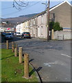
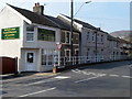
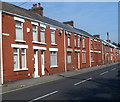
The postcode SA12 9PY defines a specific residential cluster in Wales, covering an area of just 1513 square metres. This small footprint accommodates a population of 1576 people, resulting in a density of 651 people per square kilometre. Living in this zone means existing within a tightly defined residential environment where neighbours are likely nearby. The area functions as a concentrated settlement rather than a sprawling district, creating an immediate sense of community for those moving here. You can expect a neighbourhood character that is established and compact, suitable for buyers seeking a defined location within the broader Swansea market. The high density relative to the land size indicates a built-up area rather than open countryside. This setting appeals to individuals who value proximity to amenities and established local infrastructure over large expanses of private garden space. The area represents a mature part of the local housing stock, where daily life revolves around the immediate vicinity of the street and surrounding pockets of development. For anyone researching homes in SA12 9PY, understanding this compact nature is essential for managing expectations regarding space and privacy.
- Area Type
- Postcode
- Area Size
- 1513 m²
- Population
- 1576
- Population Density
- 651 people/km²
The housing stock in SA12 9PY is characterised primarily by houses, distinguishing it from newer apartment-heavy developments found in parts of the South Wales Valleys. Approximately 48% of the local households own their homes, indicating a healthy level of owner-occupation that you will encounter when viewing properties here. The other 52% are renters, suggesting a mixed market that still retains a significant legacy of established homeownership. When buying homes in SA12 9PY, you are likely to find detached or semi-detached properties typical of the area's age profile. The density of 651 people per square kilometre means properties are situated close to one another, which influences both the appeal and the price points of individual dwellings. This area does not offer the ultra-low density options of the rural fringe but provides a genuine residential environment within a built-up zone. The small total area size of 1513 square metres confines the available land significantly, meaning new builds are rare and existing stock defines the market. Buyers looking at this postcode will find a straightforward market where property types remain consistent with the regional norm for houses rather than flats.
House Prices in SA12 9PY
No properties found in this postcode.
Energy Efficiency in SA12 9PY
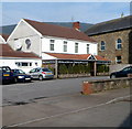
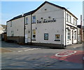
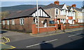
Daily life in SA12 9PY benefits from practical access to key amenities within a short radius. Retail options include Co-op Cwmavon, Tesco Port, and Spar, offering essential groceries and general shopping needs without the need for long drives. There are five notable retail venues reachable from the area, ensuring that most household shopping is conducted locally. For travel connections, rail transport is well supported with five stations in close proximity. Port Talbot Parkway Railway Station, Baglan Railway Station, and Briton Ferry Railway Station provide direct links to wider regions. Residents can rely on these transport hubs for regional commuting or leisure travel without extensive costs. The concentration of stations three to five miles away depends on the exact location within the five-station cluster but guarantees reasonable access to mainline services. Shopping trips, supermarket runs, and postal services at these Co-op and Tesco locations are easily integrated into a weekly routine. The presence of Spar further adds convenience for smaller purchases. This accessibility means you do not need to live in the town centre to enjoy urban conveniences while remaining in a quieter residential pocket.
Amenities
Schools
| Rank | School | Type | Entry gender | Ages |
|---|
Explore more schools in this area
Go to Schools tabDemographics
The community in SA12 9PY is predominantly composed of adults aged between 30 and 64 years, with a median age of 47. This age profile suggests the area attracts families with children or individuals in their middle working years who have settled down. The housing characteristics reflect this demographic, as the dominant accommodation type consists of houses rather than flats. Home ownership stands at 48%, meaning the remaining 52% of residents rent their properties. The predominant ethnic group is White, contributing to a historically established residential character. While specific data on deprivation indices is not included in the provided information, the median age of 47 indicates a population that is generally past the tenure of renting to their parents and has likely achieved some level of financial independence. The 48% ownership rate places this area in a balanced state between owner-occupiers and renters, neither being overwhelmingly one or the other. This mix often creates a stable yet dynamic community environment where long-term residents share space with younger tenants entering the housing market.
Household Size
Accommodation Type
Tenure
Ethnic Group
Religion
Household Composition
Age
Household Deprivation
NS-SEC
Explore more demographic insights in this area
Go to Demographics tabPlanning
Planning Constraints
- Flood RiskPremium
- Ramsar Wetland SitesPremium
- Area of Outstanding Natural BeautyPremium
- Protected Nature ReservePremium
- Protected WoodlandPremium
- Crime RiskPremium