Area Overview for SA12 9LT
Photos of SA12 9LT
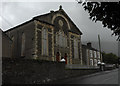
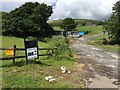
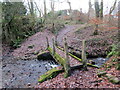
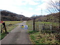
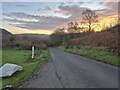
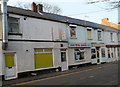
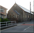
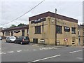
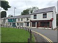
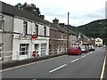
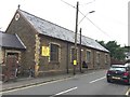
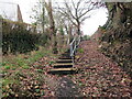
20 photos from this area
Area Information
Key information about the SA12 9LT including its size, population, and administrative classification.
- Area Type
- Postcode
- Area Size
- 1.3 hectares
- Population
- 1877
- Population Density
- 3186 people/km²
House Prices in SA12 9LT
16
Properties
£173,695
Average Sold Price
£62,000
Lowest Price
£365,000
Highest Price
Showing 16 properties
| Address | Type | Beds | Baths | Last Sale Price | Last Sale Date | |
|---|---|---|---|---|---|---|
| Woodlands, Mervyn Terrace, Cwmavon, SA12 9LT | Detached | - | - | £80,000 | Sep 2025 | |
| 7 Mervyn Terrace, Cwmavon, SA12 9LT | house | - | - | £175,000 | Aug 2024 | |
| Squirrels Run, Mervyn Terrace, Cwmavon, SA12 9LT | Detached | 4 | 3 | £365,000 | Jan 2020 | |
| 6 Mervyn Terrace, Cwmavon, SA12 9LT | house | - | - | £100,000 | Dec 2017 | |
| Groveswood House, Mervyn Terrace, Cwmavon, SA12 9LT | house | - | - | £205,000 | Jun 2016 | |
| Ty-gelli, Mervyn Terrace, Cwmavon, SA12 9LT | Bungalow | 2 | 1 | £135,000 | Dec 2013 | |
| Parc Glas, Mervyn Terrace, Cwmavon, SA12 9LT | house | 4 | - | £249,950 | Jun 2011 | |
| Fernlea, Mervyn Terrace, Cwmavon, SA12 9LT | house | - | - | £150,000 | Jul 2009 | |
| Coed Derw, Mervyn Terrace, Cwmavon, SA12 9LT | Detached | - | - | £215,000 | Aug 2005 | |
| 5 Mervyn Terrace, Cwmavon, SA12 9LT | Terraced | - | - | £62,000 | May 2003 |
Page 1 of 2
Energy Efficiency in SA12 9LT
Amenities
Schools
| Rank | School | Type | Entry gender | Ages |
|---|
Explore more schools in this area
Go to Schools tabDemographics
Household Size
Two person
most common
Accommodation Type
Houses
most common
Tenure
82
majority
Ethnic Group
White
most common
Religion
N/A
most common
Household Composition
N/A
most common
Age
47
median
Adults (30-64 years)
most common
Household Deprivation
N/A
with no deprivation
NS-SEC
32
in Lower managerial occupations
Explore more demographic insights in this area
Go to Demographics tabPlanning
Planning Constraints
- Flood RiskPremium
- Ramsar Wetland SitesPremium
- Area of Outstanding Natural BeautyPremium
- Protected Nature ReservePremium
- Protected WoodlandPremium
- Crime RiskPremium