Area Overview for SA12 8UB
Photos of SA12 8UB
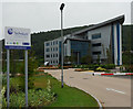

48 photos from this area
Area Information
Key information about the SA12 8UB including its size, population, and administrative classification.
- Area Type
- Postcode
- Area Size
- 1.8 hectares
- Population
- 1969
- Population Density
- 467 people/km²
House Prices in SA12 8UB
19
Properties
£194,750
Average Sold Price
£120,000
Lowest Price
£317,500
Highest Price
Showing 19 properties
| Address | Type | Beds | Baths | Last Sale Price | Last Sale Date | |
|---|---|---|---|---|---|---|
| 30 Lodge Drive, Baglan, SA12 8UB | Semi-detached | 4 | 2 | £270,000 | Dec 2023 | |
| 18 Lodge Drive, Baglan, SA12 8UB | house | - | - | £260,000 | Jun 2021 | |
| 32 Lodge Drive, Baglan, Port Talbot, SA12 8UB | Detached | 3 | 2 | £120,000 | Nov 2020 | |
| 2 Lodge Drive, Baglan, SA12 8UB | Detached | 4 | 3 | £317,500 | Jul 2020 | |
| 16 Lodge Drive, Baglan, SA12 8UB | Semi-detached | - | - | £180,000 | Jan 2018 | |
| 20 Lodge Drive, Baglan, SA12 8UB | Semi-detached | 3 | 1 | £156,000 | Apr 2017 | |
| 8 Lodge Drive, Baglan, SA12 8UB | Semi-detached | 3 | 1 | £155,000 | Sep 2016 | |
| 24 Lodge Drive, Baglan, SA12 8UB | Semi-detached | 4 | - | £162,000 | Aug 2014 | |
| 10 Lodge Drive, Baglan, SA12 8UB | house | 3 | - | £137,000 | Sep 2011 | |
| 26 Lodge Drive, Baglan, SA12 8UB | Semi-detached | - | - | £190,000 | Dec 2006 |
Page 1 of 2
Energy Efficiency in SA12 8UB
Amenities
Schools
| Rank | School | Type | Entry gender | Ages |
|---|
Explore more schools in this area
Go to Schools tabDemographics
Household Size
Family (3-5 people)
most common
Accommodation Type
Houses
most common
Tenure
83
majority
Ethnic Group
White
most common
Religion
N/A
most common
Household Composition
N/A
most common
Age
47
median
Adults (30-64 years)
most common
Household Deprivation
N/A
with no deprivation
NS-SEC
35
in Lower managerial occupations
Explore more demographic insights in this area
Go to Demographics tabPlanning
Planning Constraints
- Flood RiskPremium
- Ramsar Wetland SitesPremium
- Area of Outstanding Natural BeautyPremium
- Protected Nature ReservePremium
- Protected WoodlandPremium
- Crime RiskPremium