Area Overview for SA12 7HP
Photos of SA12 7HP
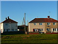
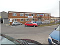

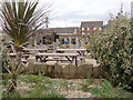
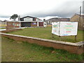

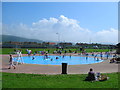
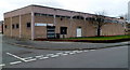
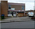
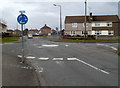
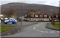
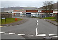
22 photos from this area
Area Information
Key information about the SA12 7HP including its size, population, and administrative classification.
- Area Type
- Postcode
- Area Size
- 5837 m²
- Population
- 1535
- Population Density
- 6415 people/km²
House Prices in SA12 7HP
16
Properties
£87,106
Average Sold Price
£26,000
Lowest Price
£167,500
Highest Price
Showing 16 properties
| Address | Type | Beds | Baths | Last Sale Price | Last Sale Date | |
|---|---|---|---|---|---|---|
| 93 Fairway, Sandfields, SA12 7HP | Terraced | 3 | 1 | £167,500 | Oct 2024 | |
| 89 Fairway, Sandfields, SA12 7HP | Terraced | 3 | 1 | £125,000 | Nov 2022 | |
| 104 Fairway, Sandfields, SA12 7HP | house | - | - | £125,000 | Sep 2022 | |
| 87 Fairway, Sandfields, SA12 7HP | house | - | - | £70,000 | Oct 2021 | |
| 106 Fairway, Sandfields, SA12 7HP | Terraced | 3 | 1 | £114,000 | Oct 2020 | |
| 102 Fairway, Sandfields, SA12 7HP | house | 3 | 1 | £94,950 | Feb 2014 | |
| 108 Fairway, Sandfields, SA12 7HP | Terraced | - | - | £26,000 | Mar 2000 | |
| 100 Fairway, Sandfields, SA12 7HP | house | - | - | £29,500 | Sep 1999 | |
| 95 Fairway, Sandfields, SA12 7HP | Terraced | 3 | 1 | £32,000 | Oct 1998 | |
| 91 Fairway, Sandfields, SA12 7HP | Terraced | - | - | - | - |
Page 1 of 2
Energy Efficiency in SA12 7HP
Amenities
Schools
| Rank | School | Type | Entry gender | Ages |
|---|
Explore more schools in this area
Go to Schools tabDemographics
Household Size
Family (3-5 people)
most common
Accommodation Type
Houses
most common
Tenure
41
majority
Ethnic Group
White
most common
Religion
N/A
most common
Household Composition
N/A
most common
Age
47
median
Adults (30-64 years)
most common
Household Deprivation
N/A
with no deprivation
NS-SEC
12
in Lower managerial occupations
Explore more demographic insights in this area
Go to Demographics tabPlanning
Planning Constraints
- Flood RiskPremium
- Ramsar Wetland SitesPremium
- Area of Outstanding Natural BeautyPremium
- Protected Nature ReservePremium
- Protected WoodlandPremium
- Crime RiskPremium