Area Overview for SA11 5AN
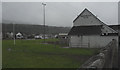
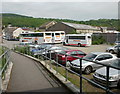
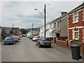
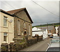
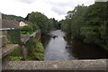
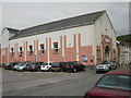
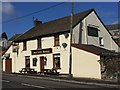
Photos of SA11 5AN


Area Information
Living in SA11 5AN means settling into a small residential cluster with a population of 1,846. You will find a tight-knit community where 1846 residents call this postcode home, creating a quiet atmosphere rather than a bustling city vibe. The area sits within Wales, offering a distinct sense of place away from the urban sprawl. Its small scale ensures that daily life revolves around familiar local spots and known neighbours. This residential cluster is characterised by low density, averaging 274 people per square kilometre. Such spacing allows for a relaxed lifestyle without the noise of major thoroughfares. Prospective buyers looking for a manageable neighbourhood will find that the population size supports a close community feel. The specific nature of this postcode area makes it suitable for those who value space and privacy. You gain access to a distinct residential environment where the pace of life remains steady. The area definition as a small residential cluster guides expectations of limited freehold estate and high local engagement.
- Area Type
- Postcode
- Area Size
- Not available
- Population
- 1846
- Population Density
- 274 people/km²
House Prices in SA11 5AN
No properties found in this postcode.
Energy Efficiency in SA11 5AN
Amenities
Schools
| Rank | School | Type | Entry gender | Ages |
|---|
Explore more schools in this area
Go to Schools tabDemographics
The community in SA11 5AN reflects a settled population with a median age of 47 years. The most common age range consists of adults between 30 and 64 years old. You will find that 76 per cent of residents own their homes outright or with a mortgage. This high ownership rate indicates a stable community invested in the local streets. Houses represent the primary accommodation type, meaning you are unlikely to find purpose-built flats here. The predominant ethnic group is white, which shapes the cultural fabric of the area. This demographic profile points to a neighbourhood where families and established professionals live alongside each other. The concentration of adults in the working years suggests a workforce present throughout the year. Home ownership levels far exceed the national average for older areas. Consequently, AM04 residential properties tend to change hands less frequently than in transient districts. The age and ownership data paints a picture of long-term residents who have chosen to stay. This stability often translates into lower tenant turnover rates compared to other districts.
Household Size
Accommodation Type
Tenure
Ethnic Group
Religion
Household Composition
Age
Household Deprivation
NS-SEC
Explore more demographic insights in this area
Go to Demographics tabPlanning
Planning Constraints
- Flood RiskPremium
- Ramsar Wetland SitesPremium
- Area of Outstanding Natural BeautyPremium
- Protected Nature ReservePremium
- Protected WoodlandPremium
- Crime RiskPremium