Area Overview for SA11 3UE
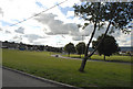
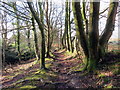
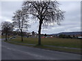
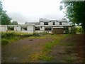
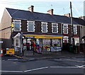
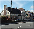
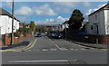
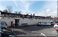
Photos of SA11 3UE

Area Information
Living in SA11 3UE offers a snapshot of established Welsh residential life within the Swansea postcode region. This specific postcode covers a small residential cluster measuring just 9225 square metres. The area houses a population of 1471 people, creating a compact, neighbourhood-focused environment. Residents navigate a landscape defined by its limited footprint, which concentrates daily interactions within immediate proximity. You will find that life here revolves around established patterns rather than rapid expansion, as the area maintains a defined character. The community functions as a cohesive unit where local traffic and neighbourly relations form the backbone of daily existence. The density of the population relative to the land size suggests a close-knit arrangement where homes stand near one another. This setup fosters familiarity, as you are likely to recognise regular faces on your street. The location sits in Wales, bringing specific cultural and geographical context to your residence. Whether you are considering buying or selling a property here, understanding the physical constraints of this small cluster is essential. The area does not sprawl; it exists as a distinct pocket of homes designed for local living. Your day-to-day rhythm will be shaped by this compact geography, influencing how you travel, shop, and socialise with those around you.
- Area Type
- Postcode
- Area Size
- 9225 m²
- Population
- 1471
- Population Density
- 3635 people/km²
The property market in SA11 3UE reflects a traditional, owner-occupied housing stock typical of established Welsh residential zones. With 88 per cent of homes in this postcode owned by residents, the market functions less like a rental hotbed and more like a established settlement. This high rate of ownership suggests that most properties were purchased with the intention of staying for the long haul. You will find that the vast majority of the housing stock comprises houses rather than apartments or flat conversions. This predominance of detached or semi-detached homes indicates a market suited to families or couples seeking single-level living without shared walls. Because owner occupation is so prevalent, you are unlikely to encounter high volumes of temporary lettings or transient tenants on the streets. If you are looking to buy a home in SA11 3UE, you are entering a market where previous owners cared deeply about their properties. The limited total population of 1471 means the total number of homes available is small, making each individual property significant. The lack of rental pressure helps maintain property values and keeps the floor of the market stable. For sellers, this environment often yields loyal local buyers who know their neighbours and value permanence over investment potential.
House Prices in SA11 3UE
Showing 30 properties
| Address | Type | Beds | Baths | Last Sale Price | Last Sale Date | |
|---|---|---|---|---|---|---|
| 141 Cimla Road, Cimla, SA11 3UE | Terraced | 3 | 1 | £100,000 | Oct 2022 | |
| 103 Cimla Road, Cimla, SA11 3UE | Retail | 3 | 1 | £90,000 | Sep 2022 | |
| 91 Cimla Road, Cimla, SA11 3UE | Detached | 3 | 1 | £137,000 | Nov 2019 | |
| 137 Cimla Road, Cimla, SA11 3UE | Terraced | 3 | 1 | £95,000 | Jun 2018 | |
| 131 Cimla Road, Cimla, SA11 3UE | Terraced | 2 | - | £117,000 | Nov 2015 | |
| 107 Cimla Road, Cimla, SA11 3UE | Terraced | 3 | - | £95,000 | Sep 2015 | |
| 113 Cimla Road, Cimla, SA11 3UE | house | 3 | - | £178,000 | Aug 2011 | |
| 143 Cimla Road, Cimla, SA11 3UE | Terraced | - | - | £95,000 | Aug 2008 | |
| 117 Cimla Road, Cimla, SA11 3UE | Semi-detached | - | - | £155,000 | Aug 2008 | |
| 129 Cimla Road, Cimla, SA11 3UE | house | - | - | £111,000 | Oct 2007 |
Energy Efficiency in SA11 3UE
Daily life in SA11 3UE benefits from practical access to essential amenities located just beyond the immediate residential cluster. Residents enjoy convenient retail options, including Tesco Neath, Iceland Neath, and Lidl Briton. These supermarkets are the primary destinations for weekly shopping, offering full ranges of groceries, household goods, and daily necessities. You do not need to travel far to find what you need, as these large stores are considered within practical reach. For rail travel, the nearest stations are Neath Railway Station, Briton Ferry Railway Station, and Skewen Railway Station. These five rail terminals provide the main artery for leaving the local area, connecting you to the wider network of South Wales. While the postcode itself is residential, the surrounding infrastructure ensures you have access to both daily sustenance and occasional travel needs. The character of the area is shaped by these nearby high streets and transport hubs. Shopping trips are straightforward, often handled while Juggernauting to the local stores rather than requiring dedicated leisure days. The presence of Iceland and Lidl specifically caters to families requiring value-for-money options alongside full-range offerings. This logistical convenience allows you to focus on home life while knowing your essential services are a short drive away.
Amenities
Schools
| Rank | School | Type | Entry gender | Ages |
|---|
Explore more schools in this area
Go to Schools tabDemographics
The community in SA11 3UE is defined by an older demographic profile compared to many other parts of the country. Data indicates that adults aged between 30 and 64 years constitute the most common age range. The median age for residents is 47, reflecting a population that has put down deep roots rather than one dominated by students or young professionals. Consequently, you will encounter a settlement where families and mature homeowners form the bulk of the population. Home ownership is exceptionally high in this postcode, with 88 per cent of properties owned outright or with a mortgage. This statistic confirms that the area is not a hub for short-term renting or speculative buy-to-let investments. Instead, it is a place where residents stay long term, fostering stability within the streets. The primary accommodation type consists of houses, aligning with the intention of families and couples seeking permanent residences. Furthermore, the predominant ethnic group is White, which mirrors the broader demographic makeup of the Swansea region. If you are looking for a neighbourhood where people live through several decades, this area offers that definitive stability. The age spread means you will not find large concentrations of teenagers or elderly residents living alone, creating a balanced residential environment.
Household Size
Accommodation Type
Tenure
Ethnic Group
Religion
Household Composition
Age
Household Deprivation
NS-SEC
Explore more demographic insights in this area
Go to Demographics tabPlanning
Planning Constraints
- Flood RiskPremium
- Ramsar Wetland SitesPremium
- Area of Outstanding Natural BeautyPremium
- Protected Nature ReservePremium
- Protected WoodlandPremium
- Crime RiskPremium