Area Overview for SA11 3TQ
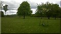
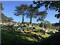
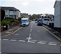
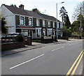
Photos of SA11 3TQ


Area Information
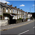
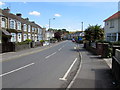
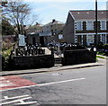
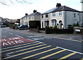
Living in SA11 3TQ means inhabiting a tightly defined residential cluster on the border between England and Wales. This specific postcode covers a mere 1.4 hectares, housing a population of 1263 people. The density is intense, with 91258 people per square kilometre, yet the layout remains residential. You will find a community that is compact by design, where neighbours are close and local services are within easy reach. This area serves as a small but distinct pocket within the Swansea postcode system, defined by its proximity to larger urban centres. The setting offers a straightforward living experience without the sprawling distances often found in larger cities. Prospective buyers should view SA11 3TQ as a functional residential zone rather than a sprawling suburb. The small size creates a cohesive environment where daily errands take minimal travel time.
- Area Type
- Postcode
- Area Size
- 1.4 hectares
- Population
- 1263
- Population Density
- 1527 people/km²
Homes in SA11 3TQ are characterised by a stable market rooted in local ownership. Exactly half of the residents, or 50%, are homeowners, which implies a significant stock of established properties rather than transient rental blocks. The predominant accommodation type in this postcode is houses, meaning you will encounter a landscape defined by traditional residential architecture rather than high-rise developments or purpose-built flats. This ownership model suggests that the area has matured beyond its initial development phase. Buyers looking for a foothold in Swansea should consider that the foundation of SA11 3TQ is built on owner-occupied properties. This dynamic often results in slower turnover compared to newer rental estates. The mix of houses offers varying levels of space and garden potential, fitting the needs of the adult-led demographics. While the exact property prices are not detailed here, the high concentration of houses and ownership indicates a market focused on permanence and equity building for residents.
House Prices in SA11 3TQ
Showing 28 properties
| Address | Type | Beds | Baths | Last Sale Price | Last Sale Date | |
|---|---|---|---|---|---|---|
| 26 Gnoll View, Neath, SA11 3TQ | Flat | 2 | 1 | £80,000 | Apr 2025 | |
| 20 Gnoll View, Neath, SA11 3TQ | Flat | 1 | 1 | £98,000 | Mar 2025 | |
| 7 Gnoll View, Neath, SA11 3TQ | Flat | - | - | £90,000 | Jan 2024 | |
| 27 Gnoll View, Neath, SA11 3TQ | Flat | - | - | £70,000 | Apr 2018 | |
| 1 Gnoll View, Neath, SA11 3TQ | Flat | - | - | £64,500 | Jul 2015 | |
| 5 Gnoll View, Neath, SA11 3TQ | Flat | - | - | £57,500 | May 2011 | |
| 10 Gnoll View, Neath, SA11 3TQ | Flat | 1 | - | £47,000 | May 2010 | |
| 2 Gnoll View, Neath, SA11 3TQ | Flat | - | - | £73,000 | Dec 2005 | |
| 19 Gnoll View, Neath, SA11 3TQ | Flat | - | - | £68,000 | Nov 2005 | |
| 14 Gnoll View, Neath, SA11 3TQ | Flat | - | - | £25,000 | Jul 2002 |
Energy Efficiency in SA11 3TQ
Your daily life in SA11 3TQ is supported by a network of amenities in the immediate vicinity. Five major retail locations are within practical reach, ensuring you have options for grocery shopping and essentials. You can easily access Iceland Neath for fresh produce, visit Morrisons Llantwit for larger household needs, or shop at Tesco Neath for a convenient weekly run. For residents who prefer rail travel, the area is well-positioned near five key railway stations. Neath Railway Station, Briton Ferry Railway Station, and Skewen Railway Station are all accessible, offering direct links to broader travel networks. This variety of transport links means you have flexibility in how you commute or plan weekend trips away. The proximity of these facilities ensures that significant journeys to larger towns are not necessary for basic shopping or daily tasks. Living in SA11 3TQ offers the convenience of urban amenities with the reduced travel times of a small residential cluster.
Amenities
Schools
| Rank | School | Type | Entry gender | Ages |
|---|
Explore more schools in this area
Go to Schools tabDemographics
The community in SA11 3TQ is predominately made up of adults aged between 30 and 64 years. The median age for residents here stands at 47, indicating a mature population that has established permanent careers and families. Half of all households in this postcode, representing 50% of the community, own their homes outright or with a mortgage. The remaining residents likely rely on the private rental sector. Houses form the primary accommodation type, suggesting a preference for detached or semi-detached living spaces over flats or apartments. The demographic profile is overwhelmingly White, reflecting the traditional composition of this part of the Swansea area. This age structure and ownership split point towards a neighbourhood where long-term stability is common. Families with older children or empty nesters often dominate the street scenes. The lack of younger children in the median age range suggests schools nearby will cater mainly to pre-teens and teenagers.
Household Size
Accommodation Type
Tenure
Ethnic Group
Religion
Household Composition
Age
Household Deprivation
NS-SEC
Explore more demographic insights in this area
Go to Demographics tabPlanning
Planning Constraints
- Flood RiskPremium
- Ramsar Wetland SitesPremium
- Area of Outstanding Natural BeautyPremium
- Protected Nature ReservePremium
- Protected WoodlandPremium
- Crime RiskPremium