Area Overview for SA11 3PH
Photos of SA11 3PH
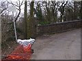
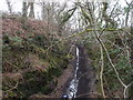
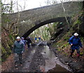
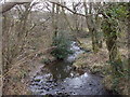
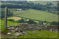
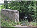
11 photos from this area
Area Information
Key information about the SA11 3PH including its size, population, and administrative classification.
- Area Type
- Postcode
- Area Size
- 9392 m²
- Population
- 1471
- Population Density
- 3635 people/km²
House Prices in SA11 3PH
21
Properties
£104,536
Average Sold Price
£51,500
Lowest Price
£187,000
Highest Price
Showing 21 properties
| Address | Type | Beds | Baths | Last Sale Price | Last Sale Date | |
|---|---|---|---|---|---|---|
| 35 Clos Ysbyty, Cimla, SA11 3PH | Semi-detached | 3 | 1 | £144,000 | Mar 2023 | |
| 5 Clos Ysbyty, Cimla, SA11 3PH | Detached | 4 | 2 | £187,000 | Feb 2019 | |
| 17 Clos Ysbyty, Cimla, SA11 3PH | Terraced | 2 | 1 | £85,000 | Feb 2017 | |
| 13 Clos Ysbyty, Cimla, SA11 3PH | Semi-detached | 3 | 1 | £111,000 | Mar 2016 | |
| 39 Clos Ysbyty, Cimla, SA11 3PH | Semi-detached | 3 | 1 | £122,000 | Aug 2014 | |
| 23 Clos Ysbyty, Cimla, SA11 3PH | house | 3 | - | £119,500 | Jan 2011 | |
| 33 Clos Ysbyty, Cimla, SA11 3PH | Detached | - | - | £157,000 | Jun 2007 | |
| 41 Clos Ysbyty, Cimla, SA11 3PH | house | 3 | - | £134,000 | Sep 2006 | |
| 11 Clos Ysbyty, Cimla, SA11 3PH | Semi-detached | 3 | 1 | £110,000 | Oct 2005 | |
| 37 Clos Ysbyty, Cimla, SA11 3PH | Semi-detached | - | - | £103,000 | Mar 2005 |
Page 1 of 3
Energy Efficiency in SA11 3PH
Amenities
Schools
| Rank | School | Type | Entry gender | Ages |
|---|
Explore more schools in this area
Go to Schools tabDemographics
Household Size
Two person
most common
Accommodation Type
Houses
most common
Tenure
88
majority
Ethnic Group
White
most common
Religion
N/A
most common
Household Composition
N/A
most common
Age
47
median
Adults (30-64 years)
most common
Household Deprivation
N/A
with no deprivation
NS-SEC
38
in Lower managerial occupations
Explore more demographic insights in this area
Go to Demographics tabPlanning
Planning Constraints
- Flood RiskPremium
- Ramsar Wetland SitesPremium
- Area of Outstanding Natural BeautyPremium
- Protected Nature ReservePremium
- Protected WoodlandPremium
- Crime RiskPremium