Area Overview for SA11 3AS
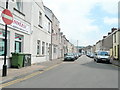
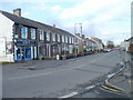
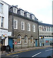
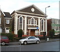
Photos of SA11 3AS


Area Information
Living in SA11 3AS offers a specific residential experience within the wider Swansea area. This postcode covers a small residential cluster spanning just 956 square metres. Despite the compact footprint, the area supports a population of 1,150 residents, creating a closely knit neighbourhood feel. You will find this location defined by its immediate proximity to key retail and transport hubs rather than expansive open space. The density reaches an unusually high 1,202,926 people per square kilometre, indicating a very concentrated settlement pattern typical of specific urban clusters. Daily life here revolves around access to major infrastructure and the convenience of being located near significant commercial and rail points. The environment is characterised by its function as a bridge between local residential streets and the broader services available in Neath and Llantwit Major. You can expect a quiet street scene that quickly connects to the busier thoroughfares of mainland Wales. The area does not sit within protected zones like Areas of Outstanding Natural Beauty or Ramsar wetland sites, suggesting planning offers standard flexibility. Consequently, the physical setting is dictated by urban development patterns rather than landscape conservation constraints. For a prospective buyer, understanding the scale of this postcode cluster is essential, as it defines the unique footprint of life here. You are living in a space designed for efficient access rather than rural isolation.
- Area Type
- Postcode
- Area Size
- 956 m²
- Population
- 1150
- Population Density
- 2409 people/km²
The housing stock in SA11 3AS is defined by its composition of houses, which serves as the primary accommodation type for the 1,150 residents. With home ownership standing at 37%, the market presents a balanced picture of permanence and flexibility. The majority of properties are likely tenanted, indicating a dynamic environment where turnover can occur more frequently than in areas with higher owner-occupier rates. When looking at homes in SA11 3AS, you are searching for a specific cluster of residential properties rather than a sprawling district. The concentration of 956 square metres means the housing stock is limited and potentially competitively priced or sought after due to scarcity. Buyers looking for houses here will find a stock that caters to the needs of the prevalent 30-64 age group. The low ownership percentage might suggest opportunities for investment or rental yield, or conversely, challenges in securing long-term stability without a fixed-term lease. The area's proximity to transport links and retail outlets adds practical value to these houses, making them attractive for commuters. Understanding the mix of freehold and leasehold properties requires checking individual listings, but the overarching theme is a house-dominated landscape within a very small geographic footprint.
House Prices in SA11 3AS
No properties found in this postcode.
Energy Efficiency in SA11 3AS
Your lifestyle in SA11 3AS is heavily dependent on the immediate accessibility of major retail and rail hubs. Within practical reach, you have access to five retail outlets, with Iceland Neath, Morrisons Llantwit, and Lidl Cadoxton being the most notable options. These supermarkets provide comprehensive grocery and convenience needs without requiring a long journey to the city centre. For leisure and commuting, the area is situated close to five rail stations, including Neath Railway Station, Briton Ferry Railway Station, and Skewen Railway Station. This combination places you in a well-connected position for both daily shopping and inter-town travel. The proximity to Neath Railway Station allows for efficient links to Swansea and beyond, while local stations like Skewen offer more localized travel. Outside of these main arteries, the immediate neighbourhood of SA11 3AS offers a quiet residential backdrop to the hustle of the nearby commercial hubs. You will enjoy the convenience of having large-format grocery stores and direct train access very close to your front door. The character of daily life here is one of functional convenience, blending the peace of a residential street with the utility of urban amenities.
Amenities
Schools
Education options for residents of SA11 3AS include Alderman Davies CIW Primary School. This is the only specific school detailed within practical reach of the postcode. By virtue of being a primary institution of the "other" type, it serves the foundational education needs of the local children. Families living in SA11 3AS will rely heavily on this facility for their youngest children's schooling, as no secondary schools are listed in the immediate vicinity data. The presence of a primary school indicates that the area supports young families, even if the median age is higher. You must plan your commute to Alderman Davies CIW Primary School carefully if you are moving here with a child, as the school acts as a central fixture for the community. The absence of other listed schools means that older pupils will likely travel to schools in nearby towns such as Neath or Swansea to complete their secondary education. This single-school model simplifies the local educational landscape but requires awareness of catchment areas and possible travel times. When looking at schools near SA11 3AS, your primary focus remains this specific primary provision.
| Rank | School | Type | Entry gender | Ages |
|---|
Explore more schools in this area
Go to Schools tabDemographics
The community profile of SA11 3AS reflects a mature demographic, with a median age of 47 years. The most common age range comprises adults between 30 and 64 years, suggesting a population where families and career professionals dominate. House ownership stands at 37%, meaning the majority of residents rent their homes. This statistic indicates a market where private landlords and housing associations play a significant role in accommodating the local population. The predominant ethnic group is White, which aligns with the broader Welsh demographic trends often seen in such specific postcode clusters. You should note that accommodation types are comprised primarily of houses. This type of dwelling is central to the residential character of the area, offering distinct separation from high-density flats or apartments. The relatively low home ownership rate often correlates with areas that are popular for renting or where affordability drives tenancy. For individuals considering moving here, knowing that 63% of residents do not own their homes helps you gauge the competitive nature of the rental market versus the purchase market. The age profile also suggests that services and community facilities often cater to adults and established families rather than a youth-dominated crowd.
Household Size
Accommodation Type
Tenure
Ethnic Group
Religion
Household Composition
Age
Household Deprivation
NS-SEC
Explore more demographic insights in this area
Go to Demographics tabPlanning
Planning Constraints
- Flood RiskPremium
- Ramsar Wetland SitesPremium
- Area of Outstanding Natural BeautyPremium
- Protected Nature ReservePremium
- Protected WoodlandPremium
- Crime RiskPremium