Area Overview for SA11 2PS
Photos of SA11 2PS
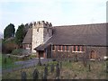
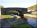
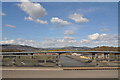
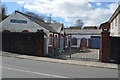
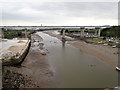
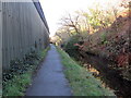
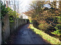
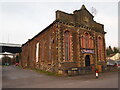
44 photos from this area
Area Information
Key information about the SA11 2PS including its size, population, and administrative classification.
- Area Type
- Postcode
- Area Size
- 9179 m²
- Population
- 1330
- Population Density
- 893 people/km²
House Prices in SA11 2PS
38
Properties
£70,498
Average Sold Price
£12,000
Lowest Price
£138,000
Highest Price
Showing 38 properties
| Address | Type | Beds | Baths | Last Sale Price | Last Sale Date | |
|---|---|---|---|---|---|---|
| 58 Shelone Road, Briton Ferry, SA11 2PS | Terraced | 3 | 2 | £130,000 | Dec 2024 | |
| 30 Shelone Road, Briton Ferry, SA11 2PS | Terraced | 2 | 1 | £112,000 | Aug 2024 | |
| 46 Shelone Road, Briton Ferry, SA11 2PS | Terraced | 3 | 1 | £138,000 | Apr 2024 | |
| 34 Shelone Road, Briton Ferry, SA11 2PS | Terraced | 3 | 1 | £105,000 | Jun 2023 | |
| 24 Shelone Road, Briton Ferry, SA11 2PS | Terraced | 2 | 1 | £45,000 | Mar 2023 | |
| 68 Shelone Road, Briton Ferry, SA11 2PS | house | 2 | 1 | £131,500 | Feb 2023 | |
| 28 Shelone Road, Briton Ferry, SA11 2PS | Terraced | 2 | - | £68,000 | Sep 2022 | |
| 56 Shelone Road, Briton Ferry, SA11 2PS | house | - | - | £132,000 | Dec 2021 | |
| 44 Shelone Road, Neath, SA11 2PS | Terraced | 3 | 1 | £112,000 | Apr 2021 | |
| 6 Shelone Road, Briton Ferry, SA11 2PS | house | - | - | £41,000 | Jun 2020 |
Page 1 of 4
Energy Efficiency in SA11 2PS
Amenities
Schools
| Rank | School | Type | Entry gender | Ages |
|---|
Explore more schools in this area
Go to Schools tabDemographics
Household Size
Two person
most common
Accommodation Type
Houses
most common
Tenure
65
majority
Ethnic Group
White
most common
Religion
N/A
most common
Household Composition
N/A
most common
Age
47
median
Adults (30-64 years)
most common
Household Deprivation
N/A
with no deprivation
NS-SEC
21
in Lower managerial occupations
Explore more demographic insights in this area
Go to Demographics tabPlanning
Planning Constraints
- Flood RiskPremium
- Ramsar Wetland SitesPremium
- Area of Outstanding Natural BeautyPremium
- Protected Nature ReservePremium
- Protected WoodlandPremium
- Crime RiskPremium