Area Overview for SA11 1EG
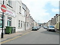
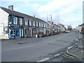
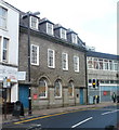
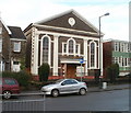
Photos of SA11 1EG


Area Information
Living in SA11 1EG means residing in a compact residential cluster within the SA11 postcode sector of Wales. This specific area shelters approximately 1,150 people, creating a tightly knit community where neighbours often know one another. The location offers a quiet, domestic setting characterised by houses rather than high-density flats. Daily life here revolves around proximity to local settlements and access to established transport links rather than being positioned in the heart of a major city centre. Homebuyers looking for homes in SA11 1EG will find a street pattern designed for established families and long-term residents. The area lacks the chaotic energy of larger urban hubs, providing instead a peaceful environment suitable for those who value stability. While the immediate surroundings are residential, practical convenience is maintained through nearby railway stations and retail parks. You will be minutes away from daily essentials, balancing suburban tranquility with functional connectivity. This postcode represents a choice for buyers prioritising a smaller, more manageable living space over the anonymity of larger districts. The character of SA11 1EG is defined by its modest population and focus on household living rather than commercial development.
- Area Type
- Postcode
- Area Size
- Not available
- Population
- 1150
- Population Density
- 2409 people/km²
The property market in SA11 1EG is defined by its distinct housing stock and ownership patterns. Houses constitute the primary accommodation type, catering specifically to those seeking standalone residential properties rather than flats or maisonettes. This focus on houses suggests that buyers are attracted to the space and privacy offered by this dwelling type. With 37% home ownership rates, the local market sees significant activity in the rental sector alongside owner-occupied stock. Only a minority of households own their homes with a mortgage, while the remaining 63% likely rent privately or through social landlords. If you are looking for homes in SA11 1EG, availability will centre on traditional residential construction. The low home ownership percentage implies that many landlords or private homeowners in the immediate vicinity manage properties for others. This dynamic often offers flexibility for renters but may mean fewer owner-occupied sellers in the traditional sense. Buyers should anticipate a market where rental demand is strong due to the higher proportion of tenant households. The concentration of houses also means that properties are likely spaced apart, offering a less dense living experience compared to apartment-heavy urban centres. Understanding this mix helps you navigate the specific inventory available for purchase or rent in this specific postcode.
House Prices in SA11 1EG
No properties found in this postcode.
Energy Efficiency in SA11 1EG
Residents of SA11 1EG enjoy access to essential amenities within practical reach, ensuring daily needs are met without long commutes. Nearby retail options include Iceland Neath, Morrisons Llantwit, and Lidl Cadoxton. These supermarkets provide a comprehensive range of groceries and household essentials, meaning you rarely need to venture far for your weekly shopping. If you prefer discount pricing, Cadoxton offers a Lidl, while Morrisons in Llantwit provides a larger selection of fresh ingredients and ready meals. Transport links are equally convenient, with five railway stations nearby, including Neath Railway Station, Briton Ferry Railway Station, and Skewen Railway Station. This connectivity allows easy travel to larger cities and employment hubs across the region. For transport enthusiasts, the Swansea Queens Dock Ferry Terminal is also accessible within a short distance. This ferry link offers a scenic alternative to road travel, potentially saving money on fuel while visiting theshore. The presence of multiple retailers and five railway stations creates a lifestyle that balances suburban quiet with urban convenience. You have immediate access to food, drink, and travel options that support a varied and active routine. This blend of local provision and broader connectivity defines the practical advantages of living in SA11 1EG.
Amenities
Schools
Families considering schools near SA11 1EG have Alderman Davies CIW Primary School as a key educational option in the immediate vicinity. This institution serves the local community and falls under the "other" category, indicating a non-state or independent character. While this specific school lacks a publicly listed Ofsted rating in the provided data, its presence confirms educational provision is close to the residential cluster. The existence of Alderman Davies CIW Primary School means you do not need to travel far to secure dedicated schooling for younger children. The limited number of listed schools reflects the small population size of the area, which totals just 1,150 residents. Larger educational institutions are likely located in nearby towns or larger villages outside this specific postcode boundary. For parents, the proximity of Alderman Davies CIW Primary School offers a convenient solution for early years education. You should verify current inspection ratings directly with the school administration or local authorities, as the available data only confirms the name and type of provision. The reliance on this single named entity highlights the importance of researching transport links to larger secondary school catchment areas if your children require education beyond the primary stage. This setup prioritises accessibility for local children over a wide choice of institutions within walking distance.
| Rank | School | Type | Entry gender | Ages |
|---|
Explore more schools in this area
Go to Schools tabDemographics
The community profile of SA11 1EG reflects a mature demographic with a median age of 47 years. Most residents fall into the adult age range of 30 to 64 years, suggesting an area populated by working families and middle-aged professionals. This age profile indicates a stable neighbourhood with established households rather than a transient student population or a bustling youth hub. Home ownership stands at 37%, meaning the majority of dwellings are occupied by tenants or those renting rather than owning their properties outright. Houses dominate the accommodation type in this postcode, with no data suggesting a prevalence of flats or apartments. This structural preference aligns with the demographic makeup of adults seeking reliable family homes. The resident population is predominantly White, mirroring the typical ethnic composition of many established residential areas in Wales. With three-quarters of the population aged over 30, the social atmosphere is likely quiet and family-oriented. You can expect a community where neighbours have likely lived in their homes for many years, fostering a sense of continuity. This demographic stability makes the area attractive to those seeking a predictable and settled environment for raising a family.
Household Size
Accommodation Type
Tenure
Ethnic Group
Religion
Household Composition
Age
Household Deprivation
NS-SEC
Explore more demographic insights in this area
Go to Demographics tabPlanning
Planning Constraints
- Flood RiskPremium
- Ramsar Wetland SitesPremium
- Area of Outstanding Natural BeautyPremium
- Protected Nature ReservePremium
- Protected WoodlandPremium
- Crime RiskPremium