Area Overview for SA11 1DZ
Photos of SA11 1DZ
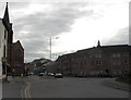
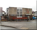
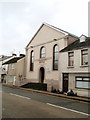
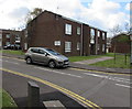
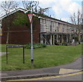

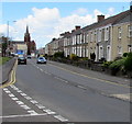
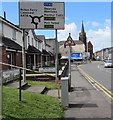
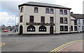

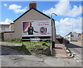
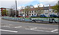
52 photos from this area
Area Information
Key information about the SA11 1DZ including its size, population, and administrative classification.
- Area Type
- Postcode
- Area Size
- 3748 m²
- Population
- 1552
- Population Density
- 6727 people/km²
House Prices in SA11 1DZ
17
Properties
£82,608
Average Sold Price
£31,000
Lowest Price
£180,000
Highest Price
Showing 17 properties
| Address | Type | Beds | Baths | Last Sale Price | Last Sale Date | |
|---|---|---|---|---|---|---|
| 9 Lewis Road, Neath, SA11 1DZ | Terraced | 2 | 1 | £87,500 | Dec 2025 | |
| 23 Lewis Road, Neath, SA11 1DZ | Terraced | 4 | 1 | £159,950 | May 2025 | |
| 19 Lewis Road, Neath, SA11 1DZ | Terraced | 2 | 1 | £73,000 | May 2023 | |
| 1 Lewis Road, Neath, SA11 1DZ | Terraced | 4 | 4 | £180,000 | Apr 2022 | |
| 15 Lewis Road, Neath, SA11 1DZ | Terraced | 3 | 2 | £71,000 | Sep 2021 | |
| 31 Lewis Road, Neath, SA11 1DZ | house | 3 | - | £70,000 | Jan 2019 | |
| 33 Lewis Road, Neath, SA11 1DZ | house | - | - | £97,500 | Jun 2012 | |
| 17 Lewis Road, Neath, SA11 1DZ | house | 2 | - | £70,000 | Feb 2012 | |
| 13 Lewis Road, Neath, SA11 1DZ | house | - | - | £70,000 | Feb 2010 | |
| 27 Lewis Road, Neath, SA11 1DZ | house | - | - | £73,000 | Aug 2004 |
Page 1 of 2
Energy Efficiency in SA11 1DZ
Amenities
Schools
| Rank | School | Type | Entry gender | Ages |
|---|
Explore more schools in this area
Go to Schools tabDemographics
Household Size
One person
most common
Accommodation Type
Houses
most common
Tenure
43
majority
Ethnic Group
White
most common
Religion
N/A
most common
Household Composition
N/A
most common
Age
47
median
Adults (30-64 years)
most common
Household Deprivation
N/A
with no deprivation
NS-SEC
16
in Lower managerial occupations
Explore more demographic insights in this area
Go to Demographics tabPlanning
Planning Constraints
- Flood RiskPremium
- Ramsar Wetland SitesPremium
- Area of Outstanding Natural BeautyPremium
- Protected Nature ReservePremium
- Protected WoodlandPremium
- Crime RiskPremium