Area Overview for SA10 6NR
Photos of SA10 6NR
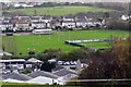
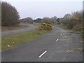

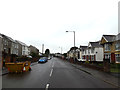
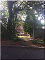
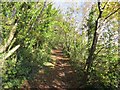
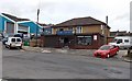
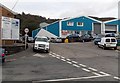
43 photos from this area
Area Information
Key information about the SA10 6NR including its size, population, and administrative classification.
- Area Type
- Postcode
- Area Size
- 52.9 hectares
- Population
- 1175
- Population Density
- 826 people/km²
House Prices in SA10 6NR
16
Properties
£250,000
Average Sold Price
£250,000
Lowest Price
£250,000
Highest Price
Showing 16 properties
| Address | Type | Beds | Baths | Last Sale Price | Last Sale Date | |
|---|---|---|---|---|---|---|
| Neuadd Drymmau, Drummau Road, Skewen, SA10 6NR | house | - | - | £250,000 | Jul 2001 | |
| The Old Laundry, Drummau Road, Skewen, SA10 6NR | Land | - | - | - | - | |
| The Caravan, Drummau Farm, Drummau Road, Skewen, SA10 6NR | Mobile Home | - | - | - | - | |
| The Lodge, Drummau Road, Skewen, SA10 6NR | Detached | - | - | - | - | |
| Wishing Well Farm, Drummau Road, Skewen, SA10 6NR | Farm | - | - | - | - | |
| Brithdir Farm, Drummau Road, Skewen, SA10 6NR | house | - | - | - | - | |
| Eurosales, Drummau Farm, Drummau Road, Skewen, SA10 6NR | warehouse | - | - | - | - | |
| Re-line Refractories Ltd, Drummau Farm, Drummau Road, Skewen, SA10 6NR | Industrial | - | - | - | - | |
| Residential Home, Neuadd Drymmau, Drummau Road, Skewen, SA10 6NR | Retirement | - | - | - | - | |
| Flat Above Stable, Oak Tree Farm, Drummau Road, Skewen, SA10 6NR | Flat | - | - | - | - |
Page 1 of 2
Energy Efficiency in SA10 6NR
Amenities
Schools
| Rank | School | Type | Entry gender | Ages |
|---|
Explore more schools in this area
Go to Schools tabDemographics
Household Size
Two person
most common
Accommodation Type
Houses
most common
Tenure
82
majority
Ethnic Group
White
most common
Religion
N/A
most common
Household Composition
N/A
most common
Age
47
median
Adults (30-64 years)
most common
Household Deprivation
N/A
with no deprivation
NS-SEC
27
in Lower managerial occupations
Explore more demographic insights in this area
Go to Demographics tabPlanning
Planning Constraints
- Flood RiskPremium
- Ramsar Wetland SitesPremium
- Area of Outstanding Natural BeautyPremium
- Protected Nature ReservePremium
- Protected WoodlandPremium
- Crime RiskPremium