Area Overview for SA10 6JR
Photos of SA10 6JR

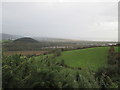


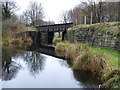
9 photos from this area
Area Information
Key information about the SA10 6JR including its size, population, and administrative classification.
- Area Type
- Postcode
- Area Size
- 1.6 hectares
- Population
- 3409
- Population Density
- 485 people/km²
House Prices in SA10 6JR
23
Properties
£131,122
Average Sold Price
£45,000
Lowest Price
£312,500
Highest Price
Showing 23 properties
| Address | Type | Beds | Baths | Last Sale Price | Last Sale Date | |
|---|---|---|---|---|---|---|
| 4 New Road, Jersey Marine, SA10 6JR | Semi-detached | 4 | 1 | £180,000 | Nov 2019 | |
| 20 New Road, Jersey Marine, SA10 6JR | Detached | 3 | 3 | £312,500 | Jul 2019 | |
| 11 New Road, Jersey Marine, SA10 6JR | Bungalow | 3 | 1 | £100,000 | Jul 2019 | |
| 9 New Road, Jersey Marine, Neath, SA10 6JR | Semi-detached | 3 | 1 | £149,950 | Apr 2018 | |
| 3 New Road, Jersey Marine, SA10 6JR | house | - | - | £139,000 | Dec 2017 | |
| 13 New Road, Jersey Marine, SA10 6JR | house | - | - | £180,000 | Oct 2016 | |
| 2 New Road, Jersey Marine, SA10 6JR | Semi-detached | 3 | - | £129,995 | Sep 2015 | |
| 14 New Road, Jersey Marine, SA10 6JR | Semi-detached | 3 | - | £130,000 | Jul 2015 | |
| 8 New Road, Jersey Marine, SA10 6JR | Semi-detached | - | - | £130,000 | Dec 2011 | |
| 12 New Road, Jersey Marine, Neath, SA10 6JR | Detached | 3 | 2 | £100,000 | Aug 2010 |
Page 1 of 3
Energy Efficiency in SA10 6JR
Amenities
Schools
| Rank | School | Type | Entry gender | Ages |
|---|
Explore more schools in this area
Go to Schools tabDemographics
Household Size
Family (3-5 people)
most common
Accommodation Type
Houses
most common
Tenure
83
majority
Ethnic Group
White
most common
Religion
N/A
most common
Household Composition
N/A
most common
Age
22
median
Young Adults (15-29 years)
most common
Household Deprivation
N/A
with no deprivation
NS-SEC
14
in Lower managerial occupations
Explore more demographic insights in this area
Go to Demographics tabPlanning
Planning Constraints
- Flood RiskPremium
- Ramsar Wetland SitesPremium
- Area of Outstanding Natural BeautyPremium
- Protected Nature ReservePremium
- Protected WoodlandPremium
- Crime RiskPremium