Area Overview for SA10 6AG
Photos of SA10 6AG
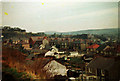
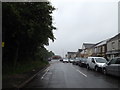
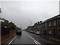
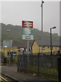
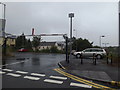
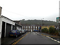
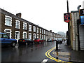
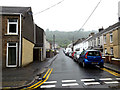
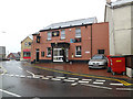
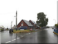
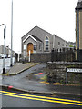
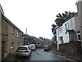
100 photos from this area
Area Information
Key information about the SA10 6AG including its size, population, and administrative classification.
- Area Type
- Postcode
- Area Size
- 3418 m²
- Population
- 1204
- Population Density
- 3853 people/km²
House Prices in SA10 6AG
12
Properties
£83,794
Average Sold Price
£32,500
Lowest Price
£160,000
Highest Price
Showing 12 properties
| Address | Type | Beds | Baths | Last Sale Price | Last Sale Date | |
|---|---|---|---|---|---|---|
| 97 Old Road, Skewen, SA10 6AG | Terraced | 3 | 1 | £160,000 | Mar 2024 | |
| 92 Old Road, Skewen, SA10 6AG | house | - | - | £86,500 | Feb 2017 | |
| 93 Old Road, Skewen, Neath, SA10 6AG | Flat | 4 | 2 | £59,500 | Sep 2014 | |
| 102 Old Road, Skewen, SA10 6AG | house | - | - | £109,000 | Dec 2007 | |
| 96 Old Road, Skewen, SA10 6AG | Terraced | - | - | £98,900 | Jan 2007 | |
| 106 Old Road, Skewen, SA10 6AG | Detached | - | - | £82,950 | Dec 2002 | |
| 95 Old Road, Skewen, SA10 6AG | house | - | - | £32,500 | Jul 2002 | |
| 94 Old Road, Skewen, SA10 6AG | Terraced | - | - | £41,000 | Nov 2001 | |
| 99 Old Road, Skewen, SA10 6AG | Terraced | - | - | - | - | |
| 100 Old Road, Skewen, SA10 6AG | house | - | - | - | - |
Page 1 of 2
Energy Efficiency in SA10 6AG
Amenities
Schools
| Rank | School | Type | Entry gender | Ages |
|---|
Explore more schools in this area
Go to Schools tabDemographics
Household Size
One person
most common
Accommodation Type
Houses
most common
Tenure
62
majority
Ethnic Group
White
most common
Religion
N/A
most common
Household Composition
N/A
most common
Age
47
median
Adults (30-64 years)
most common
Household Deprivation
N/A
with no deprivation
NS-SEC
20
in Lower managerial occupations
Explore more demographic insights in this area
Go to Demographics tabPlanning
Planning Constraints
- Flood RiskPremium
- Ramsar Wetland SitesPremium
- Area of Outstanding Natural BeautyPremium
- Protected Nature ReservePremium
- Protected WoodlandPremium
- Crime RiskPremium